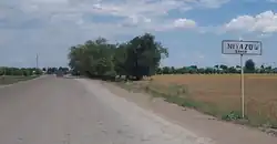
Road signs in Turkmenistan are similar to the road sign system of other post-Soviet states (e.g. Uzbekistan, Kazakhstan) that ensure that transport vehicles move safely and orderly, as well as to inform the participants of traffic built-in graphic icons. They generally conform to the Vienna Convention on Road Signs and Signals.[1] Turkmenistan acceded to the Vienna Convention on Road Signs and Signals on June 14, 1993.[2]
Road signs in Turkmenistan are based on the ГОСТ 10807-78[3][4] and ГОСТ 23457-86 Soviet standards (both of them are no longer valid in Russia) and are defined in Ýol hereketi we howpsuzlygy but with inscriptions in Turkmen language and in Latin script only.[5] However, there are road signs in Turkmenistan that are similar in design to Turkish ones and the FHWA or Arial typeface is used.[6] Road signs in Turkmenistan are a mix of post-Soviet and Turkish road sign systems.
Road signs are divided into 7 categories:
| # | Category name | Category name (in Turkmen) |
|---|---|---|
| 1 | Warning signs | Duýduryjy belgiler |
| 2 | Priority signs | Artykmaçlyk beriji belgiler |
| 3 | Prohibitory signs | Gadagan ediji belgiler |
| 4 | Mandatory signs | Buýrujy belgiler |
| 5 | Information signs | Habardar ediji – görkeziji belgiler |
| 6 | Service signs | Hyzmat belgileri |
| 7 | Additional panels | Goşmaça maglumat belgileri (tabliçkalar) |
Warning signs
- 1. Warning signs
 1.1 Railway crossing with a barrier
 1.2 Railway crossing without a barrier
 1.3.1 Single-track railway
 1.3.2 Multi-track railway
 1.4.1 Approaching a railway crossing
 1.4.2 Approaching a railway crossing
 1.4.3 Approaching a railway crossing
 1.4.4 Approaching a railway crossing
 1.4.5 Approaching a railway crossing
 1.4.6 Approaching a railway crossing
 1.5 Trams
 1.6 Intersection
 1.7 Roundabout
 1.8 Traffic signals
 1.9 Drawbridge
 1.10 Departure to the embankment
 1.11.1 Dangerous curve
 1.11.2 Dangerous curve
 1.12.1 Dangerous curves
 1.12.2 Dangerous curves
 1.13 Steep descent
 1.14 Steep climb
 1.15 Slippery road
 1.16.1 Rough road
 1.16.2 Bump
 1.17 Gravel surface
 1.18.1 Road narrows on both sides
 1.18.2 Road narrows on the right
 1.18.3 Road narrows on the left
 1.19 Two-way traffic
 1.20 Pedestrian crossing
 1.21 Children
 1.22 Intersection with a bike path or bike and pedestrian path
 1.23 Roadworks
 1.24 Cattle
 1.25 Deer
 1.26.1 Falling rocks surface
 1.27 Side wind
 1.28 Low-flying aircraft
 1.29 Tunnel
 1.30 Other hazards
 1.31.1 Hazard chevron
 1.31.2 Hazard chevron
 1.31.3 Hazard chevron
 1.32 Dangerous roadside
 1.33 Congestion
Priority signs
- 2. Priority signs
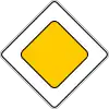 2.1 Priority road
 2.2 End of the priority road
 2.3.1 Intersection with a secondary road
 2.3.2 Secondary road junction
 2.3.3 Secondary road junction
 2.3.4 Secondary road junction
 2.3.5 Secondary road junction
 2.3.6 Secondary road junction
 2.3.7 Secondary road junction
 2.4 Give way
 2.5 Stop
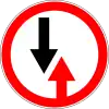 2.6 Oncoming traffic has priority
 2.7 Priority over oncoming traffic
Prohibitory signs
- 3. Prohibitory signs
 3.1 Entry is prohibited
 3.2 Traffic is prohibited
 3.3 The movement of motor vehicles is prohibited
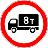 3.4 Lorries exceeding indicated weight prohibited
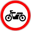 3.5 The movement of motorcycles is prohibited
 3.6 The movement of tractors is prohibited
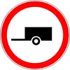 3.7 Driving with a trailer is prohibited
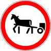 3.8 The movement of horse-drawn carts is prohibited
 3.9 Cycling is prohibited
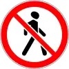 3.10 Pedestrian traffic is prohibited
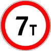 3.11 Vehicle weight limit
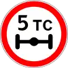 3.12 Limitation of the mass per axle of the vehicle
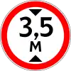 3.13 Height limit
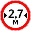 3.14 Width limit
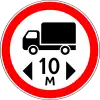 3.15 Length limit
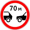 3.16 Limitation of the minimum distance
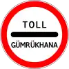 3.17.1 Customs
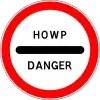 3.17.2 Danger
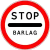 3.17.3 Control
 3.18.1 Turning to the right is prohibited
 3.18.2 Turning to the left is prohibited
 3.19 U-turn is prohibited
 3.20 Overtaking is prohibited
 3.21 End of overtaking prohibition zone
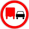 3.22 Overtaking by trucks is prohibited
 3.23 End of the zone prohibiting overtaking by trucks
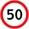 3.24 Maximum speed limit
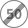 3.25 End of the maximum speed limit zone
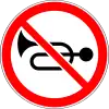 3.26 Beeping is prohibited
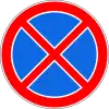 3.27 Stopping is prohibited
 3.28 Parking is prohibited
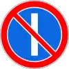 3.29 Parking is prohibited on odd days of the month
 3.30 Parking is prohibited on even days of the month
 3.31 End of all restrictions zone
 3.32 The movement of vehicles with dangerous goods is prohibited
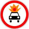 3.33 The movement of vehicles with explosive and flammable loads is prohibited
Mandatory signs
- 4. Mandatory signs
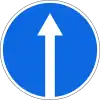 4.1.1 Driving straight
 4.1.2 Moving to the right
 4.1.3 Movement to the left
 4.1.4 Driving straight or to the right
 4.1.5 Driving straight or left
 4.1.6 Movement to the right or to the left
 4.2.1 Detour of the obstacle on the right
 4.2.2 Detour of the obstacle on the left
 4.2.3 Detour obstacles on the right of left
 4.3 Direction of roundabout traffic
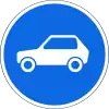 4.4 Passenger car traffic
 4.5.1 Bicycle path
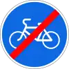 4.5.2 End of a bike lane
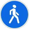 4.6.1 Footpath
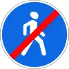 4.6.2 End of footpath
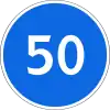 4.7 Minimum speed limit
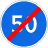 4.8 End of the minimum speed limit zone
 4.9.1 Direction of movement of vehicles with dangerous goods (turn left)
 4.9.2 Direction of movement of vehicles with dangerous goods (proceed straight)
 4.9.3 Direction of movement of vehicles with dangerous goods (turn right)
Special regulations signs
- 5. Special regulations signs
 5.1 Motorway
 5.2 End of the motorway
 5.3 Road for cars
 5.4 End of the road for cars
 5.5 One-way road
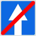 5.6 End of one-way road
 5.7.1 Exit to a one-way road
 5.7.2 Exit to a one-way road
 5.8.1 Lane directions
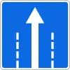 5.8.2 Lane directions
 5.8.2 Lane directions
 5.8.2 Lane directions
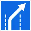 5.8.2 Lane directions
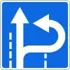 5.8.2 Lane directions
 5.8.2 Lane directions
 5.8.2 Lane directions
 5.8.3 The beginning of the lane
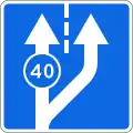 5.8.3 The beginning of the lane
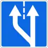 5.8.4 The beginning of the lane
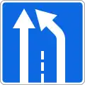 5.8.5 End of the lane
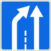 5.8.6 End of the lane
 5.8.7 Lane direction
 5.8.8 Lane direction
 5.8.8 Lane direction
 5.8.9 Number of lanes with speed limits
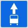 5.9 Bus lane
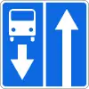 5.10.1 A road with a line for fixed-route vehicles
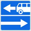 5.10.2 Exit to the road with a lane for fixed-route vehicles
 5.10.3 Exit to the road with a lane for fixed-route vehicles
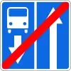 5.10.4 End of the road with a lane for fixed-route vehicles
 5.11.1 U-turn
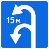 5.11.2 U-turn zone
 5.12 Bus and/or trolleybus stop location
 5.13 Tram stop location
 5.14 Parking place for passenger taxis
 5.15 Parking
 5.16.1 Pedestrian crossing
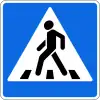 5.16.2 Pedestrian crossing
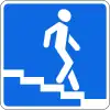 5.17.1 Subway (underpass)
 5.17.2 Subway (underpass)
 5.17.3 Footbridge
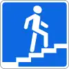 5.17.4 Footbridge
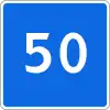 5.18 Recommended speed
 5.19.1 Dead end
 5.19.2 Dead end
 5.19.3 Dead end
 5.20.1 A preliminary sign of directions
 5.20.1 A preliminary sign of directions
 5.20.1 A preliminary sign of directions
 5.20.1 A preliminary sign of directions
 5.20.2 A preliminary sign of direction
 5.20.2 A preliminary sign of direction
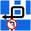 5.20.3 Traffic scheme
 5.21.1 Pointing direction
 5.21.1 Pointing direction
 5.22 Entrance to built-up area
 5.23 End of built-up area
 5.24 Entrance to locality
 5.25 End of locality
 5.27 Distance indicator
 5.28 Kilometer sign
 5.29.1 Route number
 5.30.1 Direction of movement for trucks
 5.30.2 Direction of movement for trucks
 5.30.3 Direction of movement for trucks
 5.31 Detour scheme
 5.32.1 Detour direction
 5.32.2 Detour direction
 5.32.3 Detour direction
 5.33 Stop line
 5.34.1 Preliminary index of the lane change to another carriageway
 5.34.2 Preliminary index of the lane change to another carriageway
 5.35 Residential area
 5.36 End of residential area
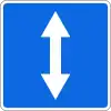 5.37 Reversible lane
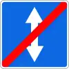 5.38 End of reversible lane
 5.39 Reversible lane
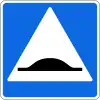 5.40 Bump
Service signs
- 6. Service signs
 6.1 Point of medical care
 6.2 Hospital
 6.3 Gas station
 6.4 Vehicle maintenance
 6.5 Car washing
 6.6 Phone
 6.7 Food point
 6.8 Drinking water
 6.9 Hotel or motel
 6.10 Camping
 6.11 Place of rest
 6.12 Traffic police post
 6.13 Police
 6.14 Transport control point
 6.15 Pool or beach
 6.16 Toilet
 6.17 Fire extinguisher
Additional plates
- 7. Additional plates
 7.1.1 Distance to the object
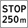 7.1.2 Distance to the object
 7.1.3 Distance to the object
 7.1.4 Distance to the object
 7.2.1 Coverage area
 7.2.2 Coverage area
 7.2.3 Coverage area
 7.2.4 Coverage area
 7.2.5 Coverage area
 7.2.6 Coverage area
 7.3.1 Directions of action
 7.3.2 Directions of action
 7.3.3 Directions of action
 7.4.1 Type of vehicle
 7.4.2 Type of vehicle
 7.4.3 Type of vehicle
 7.4.4 Type of vehicle
 7.4.5 Type of vehicle
 7.4.6 Type of vehicle
 7.4.7 Type of vehicle
 7.4.8 Type of vehicle
 7.5.1 Saturdays, Sundays and holidays
 7.5.2 Working days
 7.5.3 Days of the week
 7.5.4 Validity period
 7.5.5 Validity period
 7.5.6 Validity period
 7.5.7 Validity period
 7.6.1 Method of parking the vehicle
 7.6.2 Method of parking the vehicle
 7.6.3 Method of parking the vehicle
 7.6.4 Method of parking the vehicle
 7.6.5 Method of parking the vehicle
 7.6.6 Method of parking the vehicle
 7.6.7 Method of parking the vehicle
 7.6.8 Method of parking the vehicle
 7.6.9 Method of parking the vehicle
 7.7 Parking with an idle engine
 7.8 Paid services
 7.9 Limitation of parking duration
 7.10 Place for car inspection
 7.11 Limitation of the permitted maximum mass
 7.12 Dangerous roadside
 7.13 Direction of the main road
 7.14 Traffic lane
 7.15 Blind pedestrians
 7.16 Wet coating
 7.17 Disabled people
 7.18 Except for the disabled
 7.18.1 Obstacle
 7.18.2 Obstacle
 7.18.3 Obstacle
References
- ↑ "Vienna Convention on Road Signs and Signals - unece" (PDF). United Nations Economic Commission for Europe (UNECE). UNITED NATIONS. Retrieved 12 July 2018.
- ↑ "United Nations Treaty Collection". treaties.un.org. Retrieved 2023-12-10.
- ↑ "Межгосударственный стандарт ГОСТ 10807-78 "Знаки дорожные. Общие технические условия" (утв. постановлением Госстандарта СССР 30.08.1978 N 2401) (с изменениями и дополнениями) (не действует) | ГАРАНТ". base.garant.ru. Retrieved 2023-03-20.
- ↑ "Скачать ГОСТ 10807-78 Знаки дорожные. Общие технические условия". meganorm.ru (in Russian). Retrieved 2023-03-25.
- ↑ Atamyradow, H. (2019). Ýol hereketi we howpsuzlygy (in Turkmen). Ashgabat: Türkmen döwlet neşirýat gullugy.
- ↑ "Türkmenistan Yol Resimleri | OZGURLERTR". www.ozgurlertrafik.com.tr (in Turkish). Retrieved 2023-08-29.