Saint-Genès-Champanelle | |
|---|---|
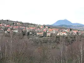 A general view of Nadaillat | |
.svg.png.webp) Coat of arms | |
Location of Saint-Genès-Champanelle | |
 Saint-Genès-Champanelle  Saint-Genès-Champanelle | |
| Coordinates: 45°43′16″N 3°01′08″E / 45.721°N 3.019°E | |
| Country | France |
| Region | Auvergne-Rhône-Alpes |
| Department | Puy-de-Dôme |
| Arrondissement | Clermont-Ferrand |
| Canton | Beaumont |
| Intercommunality | Clermont Auvergne Métropole |
| Government | |
| • Mayor (2020–2026) | Christophe Vial[1] |
| Area 1 | 51.58 km2 (19.92 sq mi) |
| Population | 3,883 |
| • Density | 75/km2 (190/sq mi) |
| Time zone | UTC+01:00 (CET) |
| • Summer (DST) | UTC+02:00 (CEST) |
| INSEE/Postal code | 63345 /63122 |
| Elevation | 660–1,252 m (2,165–4,108 ft) (avg. 887 m or 2,910 ft) |
| 1 French Land Register data, which excludes lakes, ponds, glaciers > 1 km2 (0.386 sq mi or 247 acres) and river estuaries. | |
Saint-Genès-Champanelle (French pronunciation: [sɛ̃ ʒənɛs ʃɑ̃panɛl]; Occitan: Sent Genèst de Champanela) is a commune in the Puy-de-Dôme department in Auvergne in central France.[3]
Population
| Year | Pop. | ±% p.a. |
|---|---|---|
| 1968 | 1,406 | — |
| 1975 | 1,592 | +1.79% |
| 1982 | 2,008 | +3.37% |
| 1990 | 2,465 | +2.60% |
| 1999 | 2,688 | +0.97% |
| 2007 | 3,044 | +1.57% |
| 2012 | 3,277 | +1.49% |
| 2017 | 3,612 | +1.97% |
| Source: INSEE[4] | ||
See also
References
- ↑ "Répertoire national des élus: les maires". data.gouv.fr, Plateforme ouverte des données publiques françaises (in French). 2 December 2020.
- ↑ "Populations légales 2021". The National Institute of Statistics and Economic Studies. 28 December 2023.
- ↑ INSEE commune file
- ↑ Population en historique depuis 1968, INSEE
Wikimedia Commons has media related to Saint-Genès-Champanelle.
This article is issued from Wikipedia. The text is licensed under Creative Commons - Attribution - Sharealike. Additional terms may apply for the media files.