Saint-Hérent | |
|---|---|
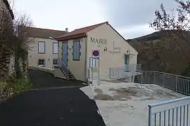 The town hall in Saint-Hérent | |
Location of Saint-Hérent | |
 Saint-Hérent  Saint-Hérent | |
| Coordinates: 45°27′32″N 3°09′04″E / 45.459°N 3.151°E | |
| Country | France |
| Region | Auvergne-Rhône-Alpes |
| Department | Puy-de-Dôme |
| Arrondissement | Issoire |
| Canton | Brassac-les-Mines |
| Intercommunality | Agglo Pays d'Issoire |
| Government | |
| • Mayor (2020–2026) | Nathalie Ferraris[1] |
| Area 1 | 12.79 km2 (4.94 sq mi) |
| Population | 113 |
| • Density | 8.8/km2 (23/sq mi) |
| Time zone | UTC+01:00 (CET) |
| • Summer (DST) | UTC+02:00 (CEST) |
| INSEE/Postal code | 63357 /63340 |
| Elevation | 480–945 m (1,575–3,100 ft) (avg. 600 m or 2,000 ft) |
| 1 French Land Register data, which excludes lakes, ponds, glaciers > 1 km2 (0.386 sq mi or 247 acres) and river estuaries. | |
Saint-Hérent (French pronunciation: [sɛ̃t‿eʁɑ̃]; Occitan: Sent Eren) is a commune in the Puy-de-Dôme department in Auvergne in central France.[3]
See also
References
- ↑ "Répertoire national des élus: les maires". data.gouv.fr, Plateforme ouverte des données publiques françaises (in French). 2 December 2020.
- ↑ "Populations légales 2021". The National Institute of Statistics and Economic Studies. 28 December 2023.
- ↑ INSEE commune file
Wikimedia Commons has media related to Saint-Hérent.
This article is issued from Wikipedia. The text is licensed under Creative Commons - Attribution - Sharealike. Additional terms may apply for the media files.