Saint-Genès-la-Tourette | |
|---|---|
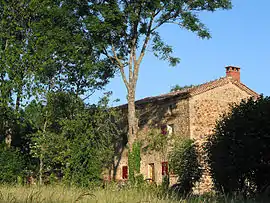 Ancient farm in the Maredon hamlet | |
.svg.png.webp) Coat of arms | |
Location of Saint-Genès-la-Tourette | |
 Saint-Genès-la-Tourette  Saint-Genès-la-Tourette | |
| Coordinates: 45°31′N 3°28′E / 45.51°N 3.47°E | |
| Country | France |
| Region | Auvergne-Rhône-Alpes |
| Department | Puy-de-Dôme |
| Arrondissement | Issoire |
| Canton | Brassac-les-Mines |
| Intercommunality | Agglo Pays d'Issoire |
| Government | |
| • Mayor (2020–2026) | Odile Gilbert[1] |
| Area 1 | 18.49 km2 (7.14 sq mi) |
| Population | 182 |
| • Density | 9.8/km2 (25/sq mi) |
| Time zone | UTC+01:00 (CET) |
| • Summer (DST) | UTC+02:00 (CEST) |
| INSEE/Postal code | 63348 /63580 |
| Elevation | 639–1,046 m (2,096–3,432 ft) (avg. 790 m or 2,590 ft) |
| 1 French Land Register data, which excludes lakes, ponds, glaciers > 1 km2 (0.386 sq mi or 247 acres) and river estuaries. | |
Saint-Genès-la-Tourette is a commune in the Puy-de-Dôme department in Auvergne in central France.[3]
See also
References
- ↑ "Répertoire national des élus: les maires". data.gouv.fr, Plateforme ouverte des données publiques françaises (in French). 2 December 2020.
- ↑ "Populations légales 2021". The National Institute of Statistics and Economic Studies. 28 December 2023.
- ↑ INSEE commune file
Wikimedia Commons has media related to Saint-Genès-la-Tourette.
This article is issued from Wikipedia. The text is licensed under Creative Commons - Attribution - Sharealike. Additional terms may apply for the media files.