Saint-Santin | |
|---|---|
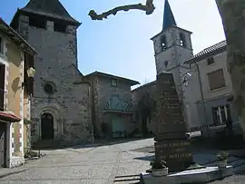 The main square and the two churches | |
Location of Saint-Santin | |
 Saint-Santin  Saint-Santin | |
| Coordinates: 44°38′59″N 2°13′09″E / 44.6497°N 2.2192°E | |
| Country | France |
| Region | Occitania |
| Department | Aveyron |
| Arrondissement | Villefranche-de-Rouergue |
| Canton | Lot et Dourdou |
| Intercommunality | Decazeville Communauté |
| Government | |
| • Mayor (2020–2026) | Michèle Couderc[1] |
| Area 1 | 22.78 km2 (8.80 sq mi) |
| Population | 523 |
| • Density | 23/km2 (59/sq mi) |
| Time zone | UTC+01:00 (CET) |
| • Summer (DST) | UTC+02:00 (CEST) |
| INSEE/Postal code | 12246 /12300 |
| Elevation | 187–592 m (614–1,942 ft) |
| 1 French Land Register data, which excludes lakes, ponds, glaciers > 1 km2 (0.386 sq mi or 247 acres) and river estuaries. | |
Saint-Santin (French pronunciation: [sɛ̃ sɑ̃tɛ̃]; Languedocien: Sent Antin), or Saint-Santin d'Aveyron, is a commune in the Aveyron department in southern France.
Since the French revolution, the town of Saint-Santin has been split in two communes in two different departments, Saint-Santin d'Aveyron and Saint-Santin-de-Maurs in the department of Cantal.[3]
Population
| Year | Pop. | ±% |
|---|---|---|
| 1962 | 684 | — |
| 1968 | 696 | +1.8% |
| 1975 | 664 | −4.6% |
| 1982 | 643 | −3.2% |
| 1990 | 575 | −10.6% |
| 1999 | 534 | −7.1% |
| 2008 | 561 | +5.1% |
See also
References
Wikimedia Commons has media related to Saint-Santin.
- ↑ "Répertoire national des élus: les maires". data.gouv.fr, Plateforme ouverte des données publiques françaises (in French). 9 August 2021.
- ↑ "Populations légales 2021". The National Institute of Statistics and Economic Studies. 28 December 2023.
- ↑ The village where everything comes in pairs, BBC
This article is issued from Wikipedia. The text is licensed under Creative Commons - Attribution - Sharealike. Additional terms may apply for the media files.