Satsuma
さつま町 | |
|---|---|
Town | |
 Clockwise from top: View of Central Satsuma Town from Tsuruta area, Tsuruta Dam, Miyanojyo Railroad Museum, Shibi Public Spa | |
 Flag  Chapter | |
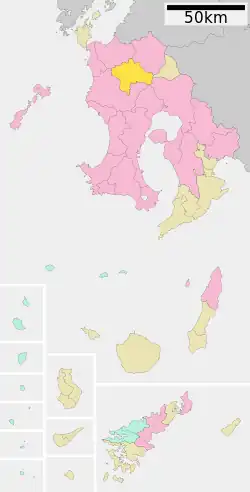 Location of Satsuma in Kagoshima Prefecture | |
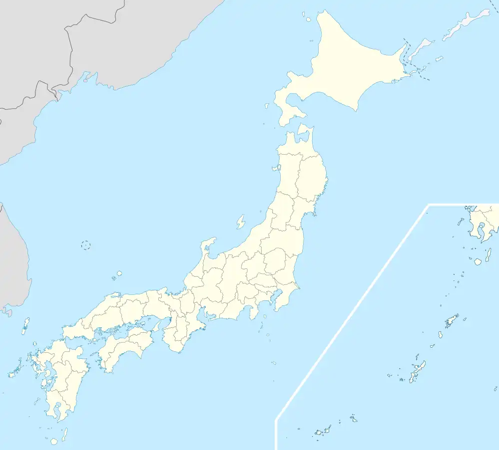 Satsuma Location in Japan | |
| Coordinates: 31°54′N 130°27′E / 31.900°N 130.450°E | |
| Country | Japan |
| Region | Kyushu |
| Prefecture | Kagoshima Prefecture |
| District | Satsuma |
| Area | |
| • Total | 303.43 km2 (117.15 sq mi) |
| Population (August 2011) | |
| • Total | 23,842 |
| • Density | 79/km2 (200/sq mi) |
| Time zone | UTC+09:00 (JST) |
| Climate | Cfa |
| Website | www |
Satsuma (さつま町, Satsuma-chō) is a town in Satsuma District, Kagoshima Prefecture, Japan.
The town was formed March 22, 2005 from the merger of the towns of Miyanojō, Tsuruda, and a former town with the English name of Satsuma (薩摩町), all from Satsuma District.
As of August 2011, the town has an estimated population of 23,842. The total area is 303.43 km².
Geography
Climate
Satsuma has a humid subtropical climate (Köppen climate classification Cfa) with hot summers and mild winters. Precipitation is significant throughout the year, and is heavier in summer, especially the months of June and July. The average annual temperature in Satsuma is 16.6 °C (61.9 °F). The average annual rainfall is 2,762.7 mm (108.77 in) with June as the wettest month. The temperatures are highest on average in August, at around 27.2 °C (81.0 °F), and lowest in January, at around 5.9 °C (42.6 °F).[1] Its record high is 37.6 °C (99.7 °F), reached on 18 August 2020, and its record low is −10.8 °C (12.6 °F), reached on 25 January 2016.[2]
| Climate data for Satsuma (1991−2020 normals, extremes 1976−present) | |||||||||||||
|---|---|---|---|---|---|---|---|---|---|---|---|---|---|
| Month | Jan | Feb | Mar | Apr | May | Jun | Jul | Aug | Sep | Oct | Nov | Dec | Year |
| Record high °C (°F) | 23.2 (73.8) |
23.4 (74.1) |
26.4 (79.5) |
30.1 (86.2) |
33.0 (91.4) |
34.0 (93.2) |
37.2 (99.0) |
37.6 (99.7) |
36.1 (97.0) |
32.9 (91.2) |
27.7 (81.9) |
24.2 (75.6) |
37.6 (99.7) |
| Mean daily maximum °C (°F) | 11.6 (52.9) |
13.2 (55.8) |
16.7 (62.1) |
21.5 (70.7) |
25.7 (78.3) |
27.7 (81.9) |
31.6 (88.9) |
32.6 (90.7) |
30.0 (86.0) |
25.3 (77.5) |
19.6 (67.3) |
13.9 (57.0) |
22.5 (72.4) |
| Daily mean °C (°F) | 5.9 (42.6) |
7.2 (45.0) |
10.5 (50.9) |
15.1 (59.2) |
19.4 (66.9) |
22.9 (73.2) |
26.7 (80.1) |
27.2 (81.0) |
24.3 (75.7) |
18.8 (65.8) |
13.1 (55.6) |
7.8 (46.0) |
16.6 (61.8) |
| Mean daily minimum °C (°F) | 0.7 (33.3) |
1.5 (34.7) |
4.6 (40.3) |
8.9 (48.0) |
13.8 (56.8) |
19.1 (66.4) |
23.1 (73.6) |
23.2 (73.8) |
19.9 (67.8) |
13.4 (56.1) |
7.4 (45.3) |
2.3 (36.1) |
11.5 (52.7) |
| Record low °C (°F) | −10.8 (12.6) |
−7.7 (18.1) |
−5.3 (22.5) |
−1.9 (28.6) |
2.7 (36.9) |
8.2 (46.8) |
16.2 (61.2) |
15.4 (59.7) |
8.7 (47.7) |
2.0 (35.6) |
−2.8 (27.0) |
−6.3 (20.7) |
−10.8 (12.6) |
| Average precipitation mm (inches) | 83.6 (3.29) |
122.5 (4.82) |
175.0 (6.89) |
214.4 (8.44) |
238.6 (9.39) |
618.6 (24.35) |
463.4 (18.24) |
278.9 (10.98) |
255.9 (10.07) |
106.4 (4.19) |
108.1 (4.26) |
97.3 (3.83) |
2,762.7 (108.77) |
| Average precipitation days (≥ 1.0 mm) | 9.4 | 9.7 | 12.3 | 10.8 | 9.9 | 16.5 | 13.9 | 12.5 | 10.8 | 7.7 | 9.0 | 8.9 | 131.4 |
| Mean monthly sunshine hours | 128.3 | 139.1 | 166.0 | 177.6 | 180.0 | 111.2 | 175.2 | 195.6 | 165.3 | 186.6 | 157.0 | 136.6 | 1,919.4 |
| Source: Japan Meteorological Agency[2][1] | |||||||||||||
Demographics
Per Japanese census data, the population of Satsuma in 2020 is 20,243 people.[3] The town's population has been slowly declining since Satsuma's census began in 1950, and the town's population shows no sign of picking up as of 2020.
| Year | Pop. | ±% |
|---|---|---|
| 1950 | 50,621 | — |
| 1955 | 49,437 | −2.3% |
| 1960 | 46,010 | −6.9% |
| 1965 | 40,343 | −12.3% |
| 1970 | 35,005 | −13.2% |
| 1975 | 31,589 | −9.8% |
| 1980 | 30,650 | −3.0% |
| 1985 | 30,284 | −1.2% |
| 1990 | 29,063 | −4.0% |
| 1995 | 28,141 | −3.2% |
| 2000 | 27,331 | −2.9% |
| 2005 | 25,688 | −6.0% |
| 2010 | 24,120 | −6.1% |
| 2015 | 22,400 | −7.1% |
| 2020 | 20,243 | −9.6% |
References
- 1 2 気象庁 / 平年値(年・月ごとの値). JMA. Retrieved March 26, 2022.
- 1 2 観測史上1~10位の値(年間を通じての値). JMA. Retrieved March 26, 2022.
- ↑ Satsuma population statistics
External links
- Official website (in Japanese)
| Core city | |||||||||||
|---|---|---|---|---|---|---|---|---|---|---|---|
| Cities |
| ||||||||||
| Districts |
| ||||||||||