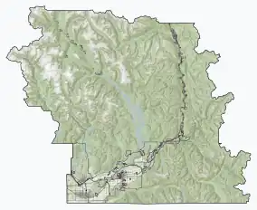
| Skagit Valley Provincial Park | |
|---|---|
| Location | Fraser Valley RD, British Columbia, Canada |
| Coordinates | 49°07′00″N 121°10′00″W / 49.11667°N 121.16667°W / 49.11667; -121.16667 |
| Area | 27,964 ha (107.97 sq mi) |
| Established | December 6, 1973 |
| Governing body | BC Parks |
| Website | bcparks |
Skagit Valley Provincial Park is a provincial park in British Columbia, Canada, centred on the Skagit River and its tributaries. The park is 27,964 Hectares. The park borders E. C. Manning Provincial Park in Canada and Ross Lake National Recreation Area and North Cascades National Park in the United States. It includes part of Ross Lake, a reservoir formed by a hydroelectric dam in Whatcom County, Washington.[2][3]
See also
References
- ↑ "Protected Planet | Skagit Valley Park". Protected Planet. Retrieved 2020-10-27.
- ↑ Official Web Site
- ↑ "Skagit Valley Park". BC Geographical Names.
External links
 Media related to Skagit Valley Provincial Park at Wikimedia Commons
| Authority control databases: National |
|---|
This article is issued from Wikipedia. The text is licensed under Creative Commons - Attribution - Sharealike. Additional terms may apply for the media files.

