Ulubey | |
|---|---|
District and municipality | |
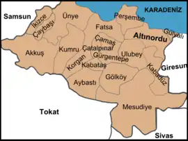 Map showing Ulubey District in Ordu Province | |
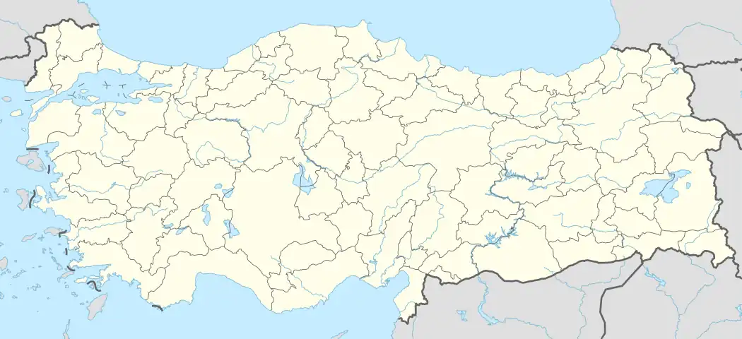 Ulubey Location in Turkey | |
| Coordinates: 40°52′34″N 37°44′26″E / 40.87611°N 37.74056°E | |
| Country | Turkey |
| Province | Ordu |
| Government | |
| • Mayor | İsa Türkcan (AKP) |
| Area | 295 km2 (114 sq mi) |
| Elevation | 602 m (1,975 ft) |
| Population (2022)[1] | 16,976 |
| • Density | 58/km2 (150/sq mi) |
| Time zone | TRT (UTC+3) |
| Postal code | 52850 |
| Area code | 0452 |
| Climate | Cfb |
| Website | www |
Ulubey is a municipality and district of Ordu Province, Turkey.[2] Its area is 295 km2,[3] and its population is 16,976 (2022).[1] The town lies at an elevation of 602 m (1,975 ft).
Economy
The economy of the district depends mainly on agriculture. Hazelnuts, beekeeping, dairy farming, corn, and kale are the main products. In recent decades the population has declined as people have migrated away to jobs in Turkey's larger cities or abroad, now mainly their grandparents remain.
Composition
There are 41 neighbourhoods in Ulubey District:[4]
- Akoluk
- Akpınar
- Aydınlar
- Başçardak
- Belenyurt
- Çağlayan
- Çatallı
- Cevizlik
- Çubuklu
- Çukur
- Doğlu
- Durakköy
- Elmaçukuru
- Eymür
- Fındıklı
- Gündüzlü
- Güvenköy
- Güvenyurt
- Güzelyurt
- Hocaoğlu
- Kadıncık
- Kalıcak
- Karakoca
- Kardeşler
- Kıranyağmur
- Kirazlık
- Koşaca
- Kumanlar
- Kumrulu
- Ohtamış
- Örenköy
- Oyumgürgen
- Refahiye
- Şahinkaya
- Şekeroluk
- Şeyhler
- Uzunmahmut
- Yenimahalle
- Yenisayaca
- Yolbaşı
- Yukarıkızılin
References
- 1 2 "Address-based population registration system (ADNKS) results dated 31 December 2022, Favorite Reports" (XLS). TÜİK. Retrieved 19 September 2023.
- ↑ Büyükşehir İlçe Belediyesi, Turkey Civil Administration Departments Inventory. Retrieved 19 September 2023.
- ↑ "İl ve İlçe Yüz ölçümleri". General Directorate of Mapping. Retrieved 19 September 2023.
- ↑ Mahalle, Turkey Civil Administration Departments Inventory. Retrieved 19 September 2023.
External links
- (in Turkish) District governor's official website
- (in Turkish) District municipality's official website
- Road map of Ulubey and environs
- Various images of Ulubey, Ordu
Ulubey, Ordu in Ordu Province of Turkey | |||||||||||||||||||||||||||
|---|---|---|---|---|---|---|---|---|---|---|---|---|---|---|---|---|---|---|---|---|---|---|---|---|---|---|---|
| Districts | 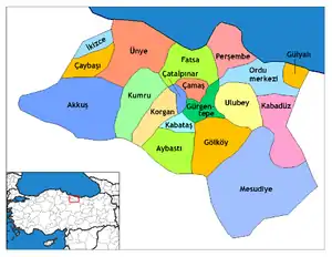 Districts of Ordu | ||||||||||||||||||||||||||
| |||||||||||||||||||||||||||
Metropolitan municipalities are bolded. | |||||||||||||||||||||||||||
This article is issued from Wikipedia. The text is licensed under Creative Commons - Attribution - Sharealike. Additional terms may apply for the media files.