Ahéville | |
|---|---|
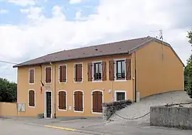 The town hall in Ahéville | |
.svg.png.webp) Coat of arms | |
Location of Ahéville | |
 Ahéville  Ahéville | |
| Coordinates: 48°17′10″N 6°11′35″E / 48.286°N 6.193°E | |
| Country | France |
| Region | Grand Est |
| Department | Vosges |
| Arrondissement | Épinal |
| Canton | Darney |
| Intercommunality | Mirecourt Dompaire |
| Government | |
| • Mayor (2020–2026) | Véronique Muniere[1] |
| Area 1 | 5.84 km2 (2.25 sq mi) |
| Population | 70 |
| • Density | 12/km2 (31/sq mi) |
| Time zone | UTC+01:00 (CET) |
| • Summer (DST) | UTC+02:00 (CEST) |
| INSEE/Postal code | 88002 /88500 |
| Elevation | 308–401 m (1,010–1,316 ft) (avg. 339 m or 1,112 ft) |
| 1 French Land Register data, which excludes lakes, ponds, glaciers > 1 km2 (0.386 sq mi or 247 acres) and river estuaries. | |
Ahéville (French pronunciation: [a.evil] ⓘ) is a commune in the Vosges department in Grand Est in northeastern France.
Population
| Year | Pop. | ±% p.a. |
|---|---|---|
| 1968 | 86 | — |
| 1975 | 80 | −1.03% |
| 1982 | 59 | −4.26% |
| 1990 | 74 | +2.87% |
| 1999 | 67 | −1.10% |
| 2007 | 63 | −0.77% |
| 2012 | 57 | −1.98% |
| 2017 | 69 | +3.90% |
| Source: INSEE[3] | ||
See also
References
- ↑ "Répertoire national des élus: les maires". data.gouv.fr, Plateforme ouverte des données publiques françaises (in French). 9 August 2021.
- ↑ "Populations légales 2021". The National Institute of Statistics and Economic Studies. 28 December 2023.
- ↑ Population en historique depuis 1968, INSEE
Wikimedia Commons has media related to Ahéville.
This article is issued from Wikipedia. The text is licensed under Creative Commons - Attribution - Sharealike. Additional terms may apply for the media files.