Xaffévillers | |
|---|---|
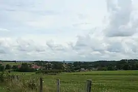 A general view of Xaffévillers | |
Location of Xaffévillers | |
 Xaffévillers  Xaffévillers | |
| Coordinates: 48°24′36″N 6°36′44″E / 48.41°N 6.6122°E | |
| Country | France |
| Region | Grand Est |
| Department | Vosges |
| Arrondissement | Épinal |
| Canton | Raon-l'Étape |
| Intercommunality | Région de Rambervillers |
| Government | |
| • Mayor (2020–2026) | Jean-Paul Hausermann[1] |
| Area 1 | 8.43 km2 (3.25 sq mi) |
| Population | 136 |
| • Density | 16/km2 (42/sq mi) |
| Time zone | UTC+01:00 (CET) |
| • Summer (DST) | UTC+02:00 (CEST) |
| INSEE/Postal code | 88527 /88700 |
| Elevation | 256–321 m (840–1,053 ft) (avg. 260 m or 850 ft) |
| 1 French Land Register data, which excludes lakes, ponds, glaciers > 1 km2 (0.386 sq mi or 247 acres) and river estuaries. | |
Xaffévillers (French pronunciation: [ksafevilɛʁ]) is a commune in the Vosges department in Grand Est in northeastern France.
Geography
The village lies in the middle of the commune, on the right bank of the Belvitte, a tributary of the Mortagne, which forms most of the commune's western border.
Population
| Year | Pop. | ±% p.a. |
|---|---|---|
| 1968 | 166 | — |
| 1975 | 130 | −3.43% |
| 1982 | 134 | +0.43% |
| 1990 | 145 | +0.99% |
| 1999 | 155 | +0.74% |
| 2007 | 141 | −1.18% |
| 2012 | 171 | +3.93% |
| 2017 | 153 | −2.20% |
| Source: INSEE[3] | ||
See also
References
- ↑ "Répertoire national des élus: les maires". data.gouv.fr, Plateforme ouverte des données publiques françaises (in French). 9 August 2021.
- ↑ "Populations légales 2021". The National Institute of Statistics and Economic Studies. 28 December 2023.
- ↑ Population en historique depuis 1968, INSEE
Wikimedia Commons has media related to Xaffévillers.
This article is issued from Wikipedia. The text is licensed under Creative Commons - Attribution - Sharealike. Additional terms may apply for the media files.