Pouxeux | |
|---|---|
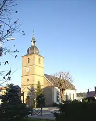
 Church of Saints Gorgon and Nabor | |
Location of Pouxeux | |
 Pouxeux  Pouxeux | |
| Coordinates: 48°06′30″N 6°34′02″E / 48.1083°N 6.5672°E | |
| Country | France |
| Region | Grand Est |
| Department | Vosges |
| Arrondissement | Épinal |
| Canton | Remiremont |
| Intercommunality | CA Épinal |
| Government | |
| • Mayor (2020–2026) | Jean-Louis Thomas[1] |
| Area 1 | 14.36 km2 (5.54 sq mi) |
| Population | 1,959 |
| • Density | 140/km2 (350/sq mi) |
| Time zone | UTC+01:00 (CET) |
| • Summer (DST) | UTC+02:00 (CEST) |
| INSEE/Postal code | 88358 /88550 |
| Elevation | 347–583 m (1,138–1,913 ft) |
| 1 French Land Register data, which excludes lakes, ponds, glaciers > 1 km2 (0.386 sq mi or 247 acres) and river estuaries. | |
Pouxeux (French pronunciation: [puksø] ⓘ) is a commune in the Vosges department in Grand Est in northeastern France.
Inhabitants are called Pexéens.
Geography
Pouxeux lies on the left bank of the Moselle, opposite its confluence with the little river Vologne. Remiremont is 13 kilometres (8 mi) upstream to the south-southeast, and Épinal is 16 kilometres (10 mi) downstream to the northwest. Pouxeux station has rail connections to Épinal, Remiremont and Nancy.
History
Before the French Revolution, Pouxeux fell within the territory of Arches, under the bailiwick of Remiremont. Its church, dedicated to Saints Gorgon and Nabor, was an annex to the church at Éloyes. Under the administrative arrangements introduced in 1790 the commune was part of the canton of Éloyes. The present administrative structure came into force some ten years later.
See also
References
- ↑ "Répertoire national des élus: les maires". data.gouv.fr, Plateforme ouverte des données publiques françaises (in French). 9 August 2021.
- ↑ "Populations légales 2021". The National Institute of Statistics and Economic Studies. 28 December 2023.