Bonate Sotto | |
|---|---|
| Comune di Bonate Sotto | |
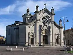 Parish church of the Holy Heart of Jesus. | |
 Coat of arms | |
Location of Bonate Sotto | |
 Bonate Sotto Location of Bonate Sotto in Italy 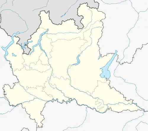 Bonate Sotto Bonate Sotto (Lombardy) | |
| Coordinates: 45°40′N 9°34′E / 45.667°N 9.567°E | |
| Country | Italy |
| Region | Lombardy |
| Province | Bergamo (BG) |
| Government | |
| • Mayor | Carlo Previtali |
| Area | |
| • Total | 6.3 km2 (2.4 sq mi) |
| Elevation | 215 m (705 ft) |
| Population (31 July 2017)[2] | |
| • Total | 6,716 |
| • Density | 1,100/km2 (2,800/sq mi) |
| Demonym | Bonatesi |
| Time zone | UTC+1 (CET) |
| • Summer (DST) | UTC+2 (CEST) |
| Postal code | 24040 |
| Dialing code | 035 |
| Patron saint | St. Sebastian |
| Saint day | 20 January |
| Website | Official website |
Bonate Sotto (Bergamasque: Bunàt Sóta) is a comune (municipality) in the Province of Bergamo in the Italian region of Lombardy, located about 40 kilometres (25 mi) northeast of Milan and about 9 kilometres (6 mi) southwest of Bergamo in the Isola bergamasca.
Outside the town are the remains of the Romanesque Basilica di Santa Giulia.
References
- ↑ "Superficie di Comuni Province e Regioni italiane al 9 ottobre 2011". Italian National Institute of Statistics. Retrieved 16 March 2019.
- ↑ All demographics and other statistics: Italian statistical institute Istat.
External links
This article is issued from Wikipedia. The text is licensed under Creative Commons - Attribution - Sharealike. Additional terms may apply for the media files.