Ranzanico | |
|---|---|
| Comune di Ranzanico | |
 Ranzanico | |
Location of Ranzanico | |
 Ranzanico Location of Ranzanico in Italy 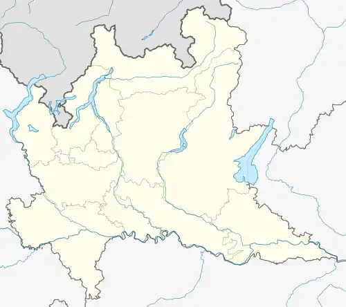 Ranzanico Ranzanico (Lombardy) | |
| Coordinates: 45°47′N 9°56′E / 45.783°N 9.933°E | |
| Country | Italy |
| Region | Lombardy |
| Province | Bergamo (BG) |
| Government | |
| • Mayor | Renato Freri |
| Area | |
| • Total | 7.21 km2 (2.78 sq mi) |
| Elevation | 519 m (1,703 ft) |
| Population (30 November 2016)[2] | |
| • Total | 1,219 |
| • Density | 170/km2 (440/sq mi) |
| Demonym | Ranzanicesi |
| Time zone | UTC+1 (CET) |
| • Summer (DST) | UTC+2 (CEST) |
| Postal code | 24060 |
| Dialing code | 035 |
| Website | Official website |
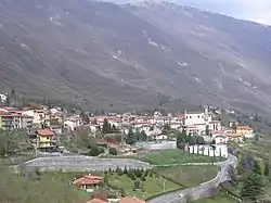
Ranzanico (Bergamasque: Ransaních) is a comune (municipality) in the Province of Bergamo in the Italian region of Lombardy, located about 70 kilometres (43 mi) northeast of Milan and about 25 kilometres (16 mi) northeast of Bergamo.
Ranzanico borders the following municipalities: Bianzano, Endine Gaiano, Gandino, Monasterolo del Castello, Peia, Spinone al Lago.
References
- ↑ "Superficie di Comuni Province e Regioni italiane al 9 ottobre 2011". Italian National Institute of Statistics. Retrieved 16 March 2019.
- ↑ All demographics and other statistics: Italian statistical institute Istat.
Wikimedia Commons has media related to Ranzanico.
This article is issued from Wikipedia. The text is licensed under Creative Commons - Attribution - Sharealike. Additional terms may apply for the media files.