Oltressenda Alta | |
|---|---|
| Comune di Oltressenda Alta | |
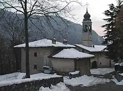 Church | |
Location of Oltressenda Alta | |
 Oltressenda Alta Location of Oltressenda Alta in Italy 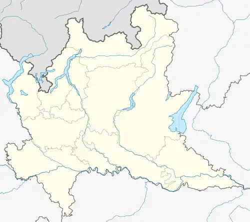 Oltressenda Alta Oltressenda Alta (Lombardy) | |
| Coordinates: 45°55′N 9°56′E / 45.917°N 9.933°E | |
| Country | Italy |
| Region | Lombardy |
| Province | Province of Bergamo (BG) |
| Area | |
| • Total | 17.3 km2 (6.7 sq mi) |
| Elevation | 714 m (2,343 ft) |
| Population (Dec. 2004)[2] | |
| • Total | 195 |
| • Density | 11/km2 (29/sq mi) |
| Demonym | Nasolinensi |
| Time zone | UTC+1 (CET) |
| • Summer (DST) | UTC+2 (CEST) |
| Postal code | 24020 |
| Dialing code | 0346 |

aerial view of Oltressanda Alta
Oltressenda Alta (Bergamasque: Oltressènda Ólta) is a comune (municipality) in the Province of Bergamo in the Italian region of Lombardy, located about 80 kilometres (50 mi) northeast of Milan and about 30 kilometres (19 mi) northeast of Bergamo. As of 31 December 2004, it had a population of 195 and an area of 17.3 square kilometres (6.7 sq mi).[3]
Oltressenda Alta borders the following municipalities: Ardesio, Clusone, Gromo, Rovetta, Villa d'Ogna, Vilminore di Scalve, Oltressenda alta has two majority localities: Nasolino and Valzurio.
Demographic evolution

References
- ↑ "Superficie di Comuni Province e Regioni italiane al 9 ottobre 2011". Italian National Institute of Statistics. Retrieved 16 March 2019.
- ↑ "Popolazione Residente al 1° Gennaio 2018". Italian National Institute of Statistics. Retrieved 16 March 2019.
- ↑ All demographics and other statistics: Italian statistical institute Istat.
This article is issued from Wikipedia. The text is licensed under Creative Commons - Attribution - Sharealike. Additional terms may apply for the media files.