Villa di Serio | |
|---|---|
| Comune di Villa di Serio | |
 Villa di Serio | |
Location of Villa di Serio | |
 Villa di Serio Location of Villa di Serio in Italy 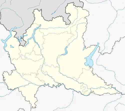 Villa di Serio Villa di Serio (Lombardy) | |
| Coordinates: 45°43′N 9°44′E / 45.717°N 9.733°E | |
| Country | Italy |
| Region | Lombardy |
| Province | Province of Bergamo (BG) |
| Frazioni | Rinnovata |
| Area | |
| • Total | 4.6 km2 (1.8 sq mi) |
| Elevation | 275 m (902 ft) |
| Population (Dec. 2004)[2] | |
| • Total | 6,118 |
| • Density | 1,300/km2 (3,400/sq mi) |
| Demonym | Villesi |
| Time zone | UTC+1 (CET) |
| • Summer (DST) | UTC+2 (CEST) |
| Postal code | 24020 |
| Dialing code | 035 |

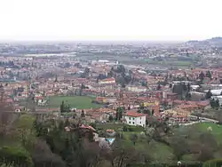
the torre della Piazza
Villa di Serio (Bergamasque: Éla de Sère) is a comune (municipality) in the Province of Bergamo in the Italian region of Lombardy, located about 50 kilometres (31 mi) northeast of Milan and about 6 kilometres (4 mi) northeast of Bergamo. As of 31 December 2004, it had a population of 6,118 and an area of 4.6 square kilometres (1.8 sq mi).[3]
The municipality of Villa di Serio contains the frazione (subdivision) Rinnovata.
Villa di Serio borders the following municipalities: Alzano Lombardo, Nembro, Ranica, Scanzorosciate.
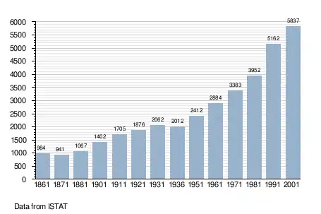
Demographic evolution
References
- ↑ "Superficie di Comuni Province e Regioni italiane al 9 ottobre 2011". Italian National Institute of Statistics. Retrieved 16 March 2019.
- ↑ "Popolazione Residente al 1° Gennaio 2018". Italian National Institute of Statistics. Retrieved 16 March 2019.
- ↑ All demographics and other statistics: Italian statistical institute Istat.
This article is issued from Wikipedia. The text is licensed under Creative Commons - Attribution - Sharealike. Additional terms may apply for the media files.