Brignano Gera d'Adda | |
|---|---|
| Comune di Brignano Gera d'Adda | |
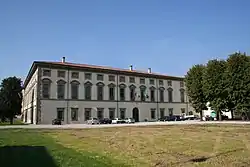
 Palazzo Vecchio. | |
 Coat of arms | |
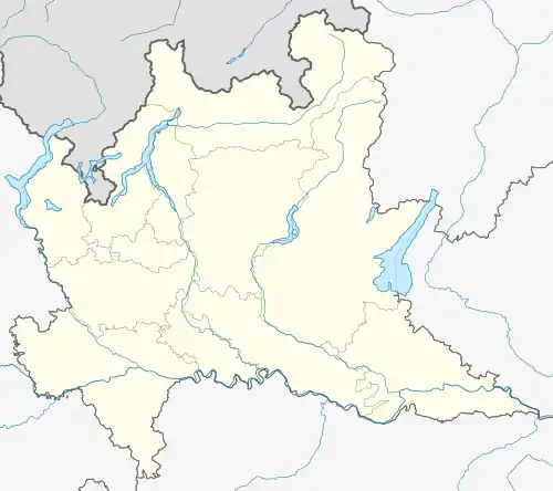
Location of Brignano Gera d'Adda | |
 Brignano Gera d'Adda Location of Brignano Gera d'Adda in Italy  Brignano Gera d'Adda Brignano Gera d'Adda (Lombardy) | |
| Coordinates: 45°32′N 9°38′E / 45.533°N 9.633°E | |
| Country | Italy |
| Region | Lombardy |
| Province | Bergamo (BG) |
| Government | |
| • Mayor | Corda Alberto |
| Area | |
| • Total | 12.11 km2 (4.68 sq mi) |
| Elevation | 128 m (420 ft) |
| Population (31 December 2017)[2] | |
| • Total | 6,009 |
| • Density | 500/km2 (1,300/sq mi) |
| Demonym | Brignanesi |
| Time zone | UTC+1 (CET) |
| • Summer (DST) | UTC+2 (CEST) |
| Postal code | 24053 |
| Dialing code | 0363 |
| Patron saint | St. Bonifacio |
| Saint day | First Sunday in October and the successive Monday |
| Website | Official website |
Wikimedia Commons has media related to Brignano Gera d'Adda.
Brignano Gera d'Adda (Bergamasque: Brignà) is a comune (municipality) in the Province of Bergamo in the Italian region of Lombardy, located about 35 kilometres (22 mi) east of Milan and about 20 kilometres (12 mi) south of Bergamo.
Main sights
The main attraction is the Palazzo Visconti, divided into a Palazzo Vecchio ("Old Palace") and a Palazzo Nuovo ("New Palace"). Originally a defensive castle known from the 10th century, it was rebuilt in the 13th to 17th centuries; it houses frescoes from the Galliari brothers, Mattia Bortoloni and Alessandro Magnasco.
The church of Sant'Andrea dates to the 11th century. It has a 15th-century entrance portico.
References
- ↑ "Superficie di Comuni Province e Regioni italiane al 9 ottobre 2011". Italian National Institute of Statistics. Retrieved 16 March 2019.
- ↑ All demographics and other statistics: Italian statistical institute Istat.
External links
This article is issued from Wikipedia. The text is licensed under Creative Commons - Attribution - Sharealike. Additional terms may apply for the media files.