Bulgnéville | |
|---|---|
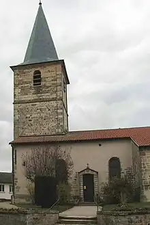 The church in Bulgnéville | |
 Coat of arms | |
Location of Bulgnéville | |
 Bulgnéville  Bulgnéville | |
| Coordinates: 48°12′29″N 5°50′07″E / 48.2081°N 5.8353°E | |
| Country | France |
| Region | Grand Est |
| Department | Vosges |
| Arrondissement | Neufchâteau |
| Canton | Vittel |
| Intercommunality | CC Terre d'eau |
| Government | |
| • Mayor (2020–2026) | Christian Franqueville[1] |
| Area 1 | 13.33 km2 (5.15 sq mi) |
| Population | 1,533 |
| • Density | 120/km2 (300/sq mi) |
| Time zone | UTC+01:00 (CET) |
| • Summer (DST) | UTC+02:00 (CEST) |
| INSEE/Postal code | 88079 /88140 |
| Elevation | 328–439 m (1,076–1,440 ft) (avg. 347 m or 1,138 ft) |
| Website | www.mairie-bulgneville.fr |
| 1 French Land Register data, which excludes lakes, ponds, glaciers > 1 km2 (0.386 sq mi or 247 acres) and river estuaries. | |
Bulgnéville (French pronunciation: [by(l)ɲevil] ⓘ) is a commune in the Vosges department in Grand Est in northeastern France.
History
The Battle of Bulgnéville took place there on 2 July 1431.
A major employer is the cheese factory of the Hermitage, which makes Le Brouère.
Saint-Pierre-et-Saint-Paul Church
See also
References
- ↑ "Répertoire national des élus: les maires" (in French). data.gouv.fr, Plateforme ouverte des données publiques françaises. 13 September 2022.
- ↑ "Populations légales 2021". The National Institute of Statistics and Economic Studies. 28 December 2023.
External links
Wikimedia Commons has media related to Bulgnéville.
This article is issued from Wikipedia. The text is licensed under Creative Commons - Attribution - Sharealike. Additional terms may apply for the media files.