 | ||||
|---|---|---|---|---|
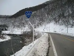
| 国道340号 | ||||
Japan National Route 340 highlighted in red | ||||
 | ||||
| Route information | ||||
| Length | 246.2 km[1] (153.0 mi) | |||
| Existed | 1 April 1975–present | |||
| Major junctions | ||||
| South end | in Rikuzentakata, Iwate | |||
| North end | in Hachinohe, Aomori | |||
| Location | ||||
| Country | Japan | |||
| Highway system | ||||
| ||||
National Route 340 (国道340号, Kokudō Sanbyakuyonjūgō) is a national highway of Japan connecting the cities of Rikuzentakata, in southeastern Iwate Prefecture, and Hachinohe, in southeastern Aomori Prefecture. It travels south to north and has a total length of 246.2 kilometers (153.0 mi). It serves primarily as an alternate, inland route to National Route 45 through the northeastern part of the Tōhoku region.
Route description
National Route 340 has a total length of 246.2 kilometers (153.0 mi).
History
National Route 340 was established by the Cabinet of Japan in 1975 between Rikuzentaka and Hachinohe.[2]
Major intersections
All junctions listed are at-grade intersections unless noted otherwise.
| Prefecture | Location | km | mi | Destinations | Notes | ||
|---|---|---|---|---|---|---|---|
| Iwate | Rikuzentakata | 0.0 | 0.0 | Southern terminus of national routes 340 and 343 | |||
| 1.7 | 1.1 | Iwate Prefecture Route 141 east | Intersection is closed due to post-2011 Tōhoku earthquake and tsunami reconstruction work | ||||
| 2.7 | 1.7 | Rikuzentakata Interchange (E45 exit 31) | |||||
| 4.9 | 3.0 | Northern end of unsigned National Route 343 concurrency | |||||
| Sumita | 17.8 | 11.1 | Southern end of National Route 107 concurrency | ||||
| 21.9 | 13.6 | Northern end of National Route 107 concurrency | |||||
| 27.4 | 17.0 | Iwate Prefecture Route 238 north | |||||
| 29.9 | 18.6 | Iwate Prefecture Route 167 east | |||||
| Tōno | 38.2 | 23.7 | Tōno-Sumita Interchange (E46 exit 6); southern end of National Route 283 concurrency | ||||
| 41.7 | 25.9 | Eastbound National Route 283 pedestrian, bicycle, or motorized traffic with engine displacement below 125cc traffic must use this road | |||||
| 45.6 | 28.3 | ||||||
| 48.4 | 30.1 | Northern end of National Route 283 concurrency | |||||
| 51.8 | 32.2 | Iwate Prefecture Route 160 west – Tsukimōshi | |||||
| Miyako | 70.9 | 44.1 | Iwate Prefecture Route 26 (former National Route 340) east – Ōtsuchi | ||||
| 78.9 | 49.0 | Iwate Prefecture Route 25 west – Shiwa | |||||
| 86.0 | 53.4 | Southern end of National Route 106 concurrency | |||||
| 87.4 | 54.3 | Iwate Prefecture Route 143 south – Rikuchū-Kawai Station | |||||
| 101.5 | 63.1 | Northern end of National Route 106 concurrency | |||||
| Iwaizumi | 129.6 | 80.5 | Iwate Prefecture Route 171 west – Okawa, Kamatsuda | ||||
| 136.8 | 85.0 | Southern end of National Route 455 concurrency | |||||
| 147.7 | 91.8 | Northern end of National Route 455 concurrency | |||||
| Kuzumaki | 160.9 | 100.0 | Iwate Prefecture Route 202 east – Fudai, Akka | ||||
| 176.3 | 109.5 | Southern end of National Route 281 concurrency | |||||
| 177.3 | 110.2 | Northern end of National Route 281 concurrency | |||||
| Kunohe | 190.7 | 118.5 | Iwate Prefecture Route 271 west – Anetai | ||||
| 190.9 | 118.6 | Iwate Prefecture Route 272 east – Nikarube | |||||
| 196.9 | 122.3 | Iwate Prefecture Route 5 east – Yamagata | Southern end of Iwate Prefecture Route 5 concurrency | ||||
| 199.8 | 124.1 | Iwate Prefecture Route 5 west – Ichinohe | Northern end of Iwate Prefecture Route 5 concurrency | ||||
| 200.5 | 124.6 | Iwate Prefecture Route 24 west – Ninohe | |||||
| 202.8 | 126.0 | Iwate Prefecture Route 22 (Karumai Kunohe Route) east – Taneichi, Kuji ,Yamagata | Kunohe Interchange (E4A exit 3) | ||||
| Karumai | 209.4 | 130.1 | Iwate Prefecture Route 264 (Ninohe Karumai Route) – Natsumagi, Kiminarita | ||||
| 212.4 | 132.0 | Southern end of National Route 395 concurrency | |||||
| 217.0 | 134.8 | Iwate Prefecture Route 33 north – Hachinohe, Nagawa | |||||
| 221.2 | 137.4 | Iwate Prefecture Route 264 (Ninohe Karumai Route) south – Central Karumai | Karumai Interchange (E4A exit 4) | ||||
| 221.3 | 137.5 | Northern end of National Route 395 concurrency | |||||
| Aomori | Hachinohe | 231.3 | 143.7 | ||||
| 242.4 | 150.6 | ||||||
| 244.4 | 151.9 | Western end of southbound side of National Route 340 one-way pair | |||||
| 244.5 | 151.9 | Western end of northbound side of National Route 340 one-way pair | |||||
| 246.2 | 153.0 | Aomori Prefecture Route 1 east –Kabushima, Tanesashi Seaside | Northern terminus; eastern end of National Route 340 one-way pair; northbound traffic continues as Aomori Prefecture Route 1 east | ||||
1.000 mi = 1.609 km; 1.000 km = 0.621 mi
| |||||||
See also
References
- ↑ "一般国道の路線別、都道府県別道路現況" [Road statistics by General National Highway route and prefecture] (PDF) (in Japanese). Ministry of Land, Infrastructure, Transport and Tourism. Retrieved 12 February 2020.
- ↑ "一般国道の路線を指定する政令" (in Japanese). Retrieved 10 October 2019 – via Wikisource.
External links
 Media related to Category:Route 340 (Japan) at Wikimedia Commons
This article is issued from Wikipedia. The text is licensed under Creative Commons - Attribution - Sharealike. Additional terms may apply for the media files.