 | ||||
|---|---|---|---|---|
| 国道36号 | ||||
 | ||||
| Route information | ||||
| Length | 133.0 km[1] (82.6 mi) | |||
| Location | ||||
| Country | Japan | |||
| Highway system | ||||
| ||||

Route 36.
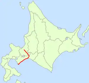
National Route 36 (国道36号, Kokudō sanjūroku-gō) is a national highway connecting Sapporo and Muroran in Hokkaidō, Japan.
Route data
- Length: 133.0 km (82.7 mi)
- Origin: Chuo-ku, Sapporo, Sapporo (originates at the origins of Routes 12 and 230)
- Terminus: Muroran, Hokkaido
- Major cities: Chitose, Tomakomai, Noboribetsu
History
Municipalities passed through
Intersects with
References
- ↑ "一般国道の路線別、都道府県別道路現況" [Road statistics by General National Highway route and prefecture] (PDF) (in Japanese). Ministry of Land, Infrastructure, Transport and Tourism. Retrieved 19 February 2020.
Wikimedia Commons has media related to Route 36 (Japan).
This article is issued from Wikipedia. The text is licensed under Creative Commons - Attribution - Sharealike. Additional terms may apply for the media files.