Kahramankazan | |
|---|---|
District and municipality | |
.jpg.webp) | |
 Logo | |
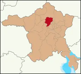
 Map showing Kahramankazan District in Ankara Province | |
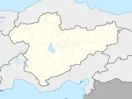
 Kahramankazan Location in Turkey  Kahramankazan Kahramankazan (Turkey Central Anatolia) | |
| Coordinates: 40°12′23″N 32°40′54″E / 40.20639°N 32.68167°E | |
| Country | Turkey |
| Province | Ankara |
| Government | |
| • Mayor | Serhat Oğuz (AKP) |
| Area | 547 km2 (211 sq mi) |
| Elevation | 892 m (2,927 ft) |
| Population (2022)[1] | 59,123 |
| • Density | 110/km2 (280/sq mi) |
| Time zone | TRT (UTC+3) |
| Postal code | 06980 |
| Area code | 0312 |
| Website | www |
Kahramankazan (before 2016: Kazan) is a municipality and district of Ankara Province, Turkey.[2] Its area is 547 km2,[3] and its population is 59,123 (2022).[1] It lies in the plain of Akıncı to the north west of the city of Ankara. Its elevation is 892 m (2,927 ft).[4]
History
Archaeological research reveals the plain has a long past, going back to prehistoric times, and findings during the excavation of the Bitik Höyük mound date back to the copper age.[5]
Kahramankazan today
Today the area is a popular weekend retreat for the people of Ankara. Kahramankazan is a busy small town. Industry in the city includes a brewery and a cement factory.
Opened in November 2011, the Turkish Satellite Assembly, Integration and Test Center (UMET), is situated in the Fethiye neighborhood of the city.
A large trona ore deposit, which lays 600 m (2,000 ft) underground, is mined and processed by Kazan Soda Elektrik of Ciner Holding in the city.[6]
The town was renamed Kahramankazan (Hero Kazan) in 2016 due to the role of local residents in opposing the 2016 Turkish coup d'état attempt.[7]
Composition
There are 48 neighbourhoods in Kahramankazan District:[8]
- Ahi
- Akçaören
- Akıncı
- Alpagut
- Aşağıkaraören
- Atatürk
- Aydın
- Bitik
- Çalta
- Ciğir
- Çimşit
- Dağyaka
- Dutözü
- Emirgazi
- Fatih
- Fethiye
- Günbaşı
- Güvenç
- İçören
- İmrendi
- İnceğiz
- İne
- İymir
- Kanuni Sultan Süleyman
- Karalar
- Kayı
- Kılıçlar
- Kınık
- Kışla
- Kumpınar
- Örencik
- Orhaniye
- Peçenek
- Sancar
- Saraç
- Saray
- Sarıayak
- Sarılar
- Satıkadın
- Soğucak
- Tekke
- Uçarı
- Yakupderviş
- Yassıören
- Yavuz Sultan Selim
- Yayalar
- Yazıbeyli
- Yıldırımbeyazıt
References
- 1 2 "Address-based population registration system (ADNKS) results dated 31 December 2022, Favorite Reports" (XLS). TÜİK. Retrieved 22 May 2023.
- ↑ Büyükşehir İlçe Belediyesi, Turkey Civil Administration Departments Inventory. Retrieved 8 June 2023.
- ↑ "İl ve İlçe Yüz ölçümleri". General Directorate of Mapping. Retrieved 22 May 2023.
- ↑ Falling Rain Genomics, Inc. "Geographical information on Kazan, Turkey". Retrieved 21 June 2023.
- ↑ "Bitik Höyük". Archived from the original on 2016-03-04.
- ↑ "Kazan Soda Elektrik" (in Turkish). Ciner Grup. Retrieved 2018-01-17.
- ↑ "Kazan ilçesinin adı 'Kahramankazan' oldu". www.aa.com.tr. Retrieved 2023-06-20.
- ↑ Mahalle, Turkey Civil Administration Departments Inventory. Retrieved 22 May 2023.
