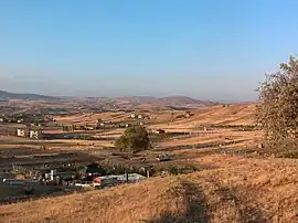
Pursaklar | |
|---|---|
District and municipality | |
 | |
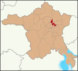
 Map showing Pursaklar District in Ankara Province | |
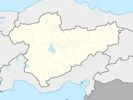
 Pursaklar Location in Turkey  Pursaklar Pursaklar (Turkey Central Anatolia) | |
| Coordinates: 40°02′19″N 32°53′49″E / 40.03861°N 32.89694°E | |
| Country | Turkey |
| Province | Ankara |
| Government | |
| • Mayor | Ertuğrul Çetin (AKP) |
| Area | 169 km2 (65 sq mi) |
| Elevation | 1,049 m (3,442 ft) |
| Population (2022)[1] | 162,389 |
| • Density | 960/km2 (2,500/sq mi) |
| Time zone | TRT (UTC+3) |
| Area code | 0312 |
| Website | www |
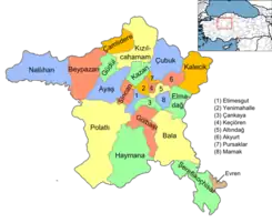
Pursaklar is a municipality and metropolitan district of Ankara Province, Turkey.[2] Its area is 169 km2,[3] and its population is 162,389 (2022).[1] It became a town municipality within the district of Keçiören in 1986.[4] In 2008 it became a district, and the former municipalities of Sarayköy, Sirkeli and Altınova (partly) were added to it.[5][6]
Composition
There are 21 neighbourhoods in Pursaklar District:[7]
- Abadan
- Altınova
- Ayyıldız
- Fatih
- Karaköy
- Karşıyaka
- Kösrelikkızığı
- Merkez
- Mimar Sinan
- Peçenek
- Saray Cumhuriyet
- Saray Fatih
- Saray Gümüşoluk
- Saray Osmangazi
- Sirkeli Yeşilova
- Sirkeli Yeşilyurt
- Tevfik Ileri
- Yeni Karaköy
- Yıldırımbeyazıt
- Yunus Emre
- Yuva
Demographics
|
| |||||||||||||||||||||||||||||||||||||||||||||
| Population data before 1986 refer to the village of Pursaklar, data between 1986 and 2007 refer to the town municipality of Pursaklar. Source: 1997 census,[9] TÜIK (2007)[10] and TÜIK (2008-2022)[1] | ||||||||||||||||||||||||||||||||||||||||||||||
References
- 1 2 3 "Population Of SRE-1, SRE-2, Provinces and Districts". TÜIK. Retrieved 27 June 2023.
- ↑ Büyükşehir İlçe Belediyesi, Turkey Civil Administration Departments Inventory. Retrieved 8 June 2023.
- ↑ "İl ve İlçe Yüz ölçümleri". General Directorate of Mapping. Retrieved 22 May 2023.
- ↑ Karar Sayısı: 86/33062, Resmî Gazete, 19 December 1986.
- ↑ Kanun No. 5747, Resmî Gazete, 22 March 2008.
- ↑ "İl İdaresi ve Mülki Bölümler Şube Müdürlüğü İstatistikleri - İl ve İlçe Kuruluş Tarihleri" (PDF) (in Turkish). p. 9. Retrieved 27 June 2023.
- ↑ Mahalle, Turkey Civil Administration Departments Inventory. Retrieved 22 May 2023.
- ↑ Turkish Statistical Institute
- ↑ "1997 Population Count" (PDF) (in Turkish). Turkish Statistical Institute. 1999. Archived (PDF) from the original on 30 October 2022.
- ↑ "Population Of Municipalities, Villages And Quarters". TÜIK. Retrieved 27 June 2023.
External links
This article is issued from Wikipedia. The text is licensed under Creative Commons - Attribution - Sharealike. Additional terms may apply for the media files.
