Krňany | |
|---|---|
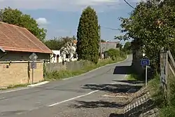 Main road | |
 Flag  Coat of arms | |
 Krňany Location in the Czech Republic | |
| Coordinates: 49°50′42″N 14°28′39″E / 49.84500°N 14.47750°E | |
| Country | |
| Region | Central Bohemian |
| District | Benešov |
| First mentioned | 1061 |
| Area | |
| • Total | 12.24 km2 (4.73 sq mi) |
| Elevation | 360 m (1,180 ft) |
| Population (2023-01-01)[1] | |
| • Total | 495 |
| • Density | 40/km2 (100/sq mi) |
| Time zone | UTC+1 (CET) |
| • Summer (DST) | UTC+2 (CEST) |
| Postal code | 257 44 |
| Website | www |
Krňany is a municipality and village in Benešov District in the Central Bohemian Region of the Czech Republic. It has about 500 inhabitants.
Administrative parts
Villages of Teletín and Třebsín are administrative parts of Krňany.
References
Wikimedia Commons has media related to Krňany.
This article is issued from Wikipedia. The text is licensed under Creative Commons - Attribution - Sharealike. Additional terms may apply for the media files.