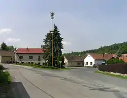
Krhanice | |
|---|---|
 Common in Krhanice | |
 Flag  Coat of arms | |
 Krhanice Location in the Czech Republic | |
| Coordinates: 49°51′22″N 14°33′27″E / 49.85611°N 14.55750°E | |
| Country | |
| Region | Central Bohemian |
| District | Benešov |
| First mentioned | 1360 |
| Area | |
| • Total | 13.45 km2 (5.19 sq mi) |
| Elevation | 276 m (906 ft) |
| Population (2023-01-01)[1] | |
| • Total | 1,101 |
| • Density | 82/km2 (210/sq mi) |
| Time zone | UTC+1 (CET) |
| • Summer (DST) | UTC+2 (CEST) |
| Postal codes | 257 41, 257 42 |
| Website | www |
Krhanice is a municipality and village in Benešov District in the Central Bohemian Region of the Czech Republic. It has about 1,100 inhabitants.
Administrative parts
Villages of Dolní Požáry and Prosečnice are administrative parts of Krhanice.
Geography
Krhanice is located about 12 kilometres (7 mi) northwest of Benešov and 20 km (12 mi) south of Prague. It lies in the Benešov Uplands. The highest point is the hill Grybla at 514 m (1,686 ft) above sea level. The municipality is situated on the right bank of the Sázava River.
History
The first written mention of Krhanice is from 1228, when the Ostrov Monastery in Davle owned half of the village. The second part probably belonged to the Zbořený Kostelec estate.[2]
Sights
There are no significant landmarks. The only cultural monuments are a niche chapel of Saint Joseph from the second half of the 18th century, and a homestead from 1813.[3]
Notable people
- Jiří Hájek (1913–1993), politician and diplomat
- Otakar Brousek Sr. (1924–2014), actor
References
- ↑ "Population of Municipalities – 1 January 2023". Czech Statistical Office. 2023-05-23.
- ↑ "Historie" (in Czech). Obec Krhanice. Retrieved 2023-05-29.
- ↑ "Výsledky vyhledávání: Kulturní památky, obec Krhanice". Ústřední seznam kulturních památek (in Czech). National Heritage Institute. Retrieved 2023-05-29.