Le Bois-Hellain | |
|---|---|
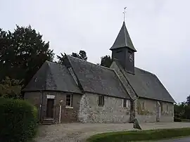 The church in Le Bois-Hellain | |
Location of Le Bois-Hellain | |
 Le Bois-Hellain  Le Bois-Hellain | |
| Coordinates: 49°16′47″N 0°23′25″E / 49.2797°N 0.3903°E | |
| Country | France |
| Region | Normandy |
| Department | Eure |
| Arrondissement | Bernay |
| Canton | Beuzeville |
| Government | |
| • Mayor (2020–2026) | Jérôme Jacques[1] |
| Area 1 | 3.2 km2 (1.2 sq mi) |
| Population | 211 |
| • Density | 66/km2 (170/sq mi) |
| Time zone | UTC+01:00 (CET) |
| • Summer (DST) | UTC+02:00 (CEST) |
| INSEE/Postal code | 27071 /27260 |
| Elevation | 90–156 m (295–512 ft) (avg. 142 m or 466 ft) |
| 1 French Land Register data, which excludes lakes, ponds, glaciers > 1 km2 (0.386 sq mi or 247 acres) and river estuaries. | |
Le Bois-Hellain (French pronunciation: [lə bwa elɛ̃]) is a commune in the Eure department in Normandy in northern France.
Population
| Year | Pop. | ±% |
|---|---|---|
| 1962 | 79 | — |
| 1968 | 113 | +43.0% |
| 1975 | 111 | −1.8% |
| 1982 | 102 | −8.1% |
| 1990 | 147 | +44.1% |
| 1999 | 158 | +7.5% |
| 2008 | 227 | +43.7% |
See also
References
- ↑ "Répertoire national des élus: les maires". data.gouv.fr, Plateforme ouverte des données publiques françaises (in French). 2 December 2020.
- ↑ "Populations légales 2021". The National Institute of Statistics and Economic Studies. 28 December 2023.
Wikimedia Commons has media related to Le Bois-Hellain.
This article is issued from Wikipedia. The text is licensed under Creative Commons - Attribution - Sharealike. Additional terms may apply for the media files.