Saint-Pierre-de-Bailleul | |
|---|---|
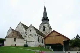 The church in Saint-Pierre-de-Bailleul | |
.svg.png.webp) Coat of arms | |
Location of Saint-Pierre-de-Bailleul | |
 Saint-Pierre-de-Bailleul  Saint-Pierre-de-Bailleul | |
| Coordinates: 49°07′25″N 1°23′25″E / 49.1236°N 1.3903°E | |
| Country | France |
| Region | Normandy |
| Department | Eure |
| Arrondissement | Les Andelys |
| Canton | Gaillon |
| Intercommunality | CA Seine-Eure |
| Government | |
| • Mayor (2020–2026) | Pascal Jumel[1] |
| Area 1 | 6.34 km2 (2.45 sq mi) |
| Population | 971 |
| • Density | 150/km2 (400/sq mi) |
| Time zone | UTC+01:00 (CET) |
| • Summer (DST) | UTC+02:00 (CEST) |
| INSEE/Postal code | 27589 /27920 |
| Elevation | 15–136 m (49–446 ft) (avg. 123 m or 404 ft) |
| 1 French Land Register data, which excludes lakes, ponds, glaciers > 1 km2 (0.386 sq mi or 247 acres) and river estuaries. | |
Saint-Pierre-de-Bailleul (French pronunciation: [sɛ̃ pjɛʁ də bajœl]) is a commune in the Eure department in Normandy in northern France.
Population
| Year | Pop. | ±% |
|---|---|---|
| 1962 | 484 | — |
| 1968 | 531 | +9.7% |
| 1975 | 624 | +17.5% |
| 1982 | 655 | +5.0% |
| 1990 | 834 | +27.3% |
| 1999 | 935 | +12.1% |
| 2008 | 1,016 | +8.7% |
See also
References
- ↑ "Répertoire national des élus: les maires". data.gouv.fr, Plateforme ouverte des données publiques françaises (in French). 2 December 2020.
- ↑ "Populations légales 2021". The National Institute of Statistics and Economic Studies. 28 December 2023.
Wikimedia Commons has media related to Saint-Pierre-de-Bailleul.
This article is issued from Wikipedia. The text is licensed under Creative Commons - Attribution - Sharealike. Additional terms may apply for the media files.