Perruel | |
|---|---|
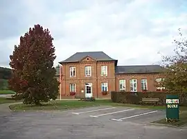 The town hall in Perruel | |
 Coat of arms | |
Location of Perruel | |
 Perruel  Perruel | |
| Coordinates: 49°25′45″N 1°22′33″E / 49.4292°N 1.3758°E | |
| Country | France |
| Region | Normandy |
| Department | Eure |
| Arrondissement | Les Andelys |
| Canton | Romilly-sur-Andelle |
| Government | |
| • Mayor (2020–2026) | Vincent Quéné[1] |
| Area 1 | 5.37 km2 (2.07 sq mi) |
| Population | 462 |
| • Density | 86/km2 (220/sq mi) |
| Time zone | UTC+01:00 (CET) |
| • Summer (DST) | UTC+02:00 (CEST) |
| INSEE/Postal code | 27454 /27910 |
| Elevation | 46–143 m (151–469 ft) (avg. 54 m or 177 ft) |
| 1 French Land Register data, which excludes lakes, ponds, glaciers > 1 km2 (0.386 sq mi or 247 acres) and river estuaries. | |
Perruel (French pronunciation: [pɛʁɥɛl]) is a commune in the Eure department in Normandy in northern France.
The village shelters the ancient abbey of Isle-Dieu, today a farm on the road between Perruel and Vascoeuil.
Population
| Year | Pop. | ±% |
|---|---|---|
| 1962 | 266 | — |
| 1968 | 310 | +16.5% |
| 1975 | 333 | +7.4% |
| 1982 | 372 | +11.7% |
| 1990 | 355 | −4.6% |
| 1999 | 401 | +13.0% |
| 2008 | 453 | +13.0% |
See also
References
- ↑ "Répertoire national des élus: les maires" (in French). data.gouv.fr, Plateforme ouverte des données publiques françaises. 13 September 2022.
- ↑ "Populations légales 2021". The National Institute of Statistics and Economic Studies. 28 December 2023.
Wikimedia Commons has media related to Perruel.
This article is issued from Wikipedia. The text is licensed under Creative Commons - Attribution - Sharealike. Additional terms may apply for the media files.