This is a list of bridges and viaducts in Bhutan, including those for pedestrians and vehicular traffic.
Historical and architectural interest bridges
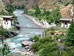
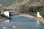
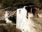
Cantilever beams were developed in order to cross increasingly wide streams or rivers, where simple wooden beams had a limited range of about 10 meters. Two arms with timber superimposed are built on either side of the river, above the highest flood-level point, while being weighted to allow an increasingly large cantilevering, and solid wooden beams are then fixed on each end of the arms with wooden pegs. Bridges of this type were very common in mountainous region of India, Nepal and Tibet with an average span of 20 metres (66 ft), but those from bhutan have the particularity of being more elaborate with stone masonry bridge towers, roofed with wooden shingles above the abutments or bridge head structures.[1][2] The main purpose of these towers was to act as a counterweight to stiffen the structure.[3]
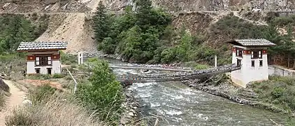
The use of more layers of wooden beams with more pronounced inclinations permit to achieve greater spans, one of the most significant example is the Wangdue Zam with a span reported from 112 to 180 feet (34.1 to 54.9 m) according to different sources.[4][5][6] The renovation of the Punakha Bridge in the city of the same name in 2008 by a swiss company[7] made it possible with this technique to reach a span of 55 metres (180 ft), the largest for this type of bridge in Bhutan.
All these bridges are called Bazam, a word composed of Ba which means Cattle and Zam who is the traduction of Bridge in Dzongkha, the national language of Bhutan. This comes from the resemblance of the cantilever beams that sit opposite each other with two noses of cattle.[8]
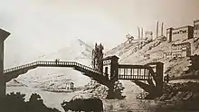
A major innovation was created by Thang Tong Gyalpo regarding the crossing of large spans, he developed iron chains working techniques and adapted them to the construction of bridges. By adding arsenic to the iron (a bit more than 2.8%),[9] it was easier to work with and had good resistance against rust, some of these chains are still functional today. This made it possible to reach spans to over a hundred meters which had not yet been reached in Europe at this time, the Chushul Chakzam in Tibet is reported to be 150 yards (140 m) long.[4]
After making more than a hundred such bridges in Tibet, Thang Tong Gyalpo came to Bhutan in 1433 where he found big iron ore deposits and locals blacksmiths, many chains forged here were shipped from Bhutan to Tibet.[10] He build 8 bridges in the country, oftentime near ore deposits, and some of them were still in use in the 20ht century, the last existing bridges are Tamchog Chakzam, Doksum Chakzam, Dangme Chakzam, and Khoma Chakzam[11] (Chakzam literally means "iron bridge" in standard Tibetan).
Major road bridges
This table presents the structures with spans greater than 100 metres (330 ft) (non-exhaustive list).
| Name | Dzongkha | Span | Length | Type | Carries Crosses |
Opened | Location | District | Ref. | ||
|---|---|---|---|---|---|---|---|---|---|---|---|
| 1 | Amochhu Bridge | 175 m (574 ft) | Arch Steel through arch | Road bridge Torsa River | 2018 | Phuntsholing 26°53′10.1″N 89°20′06.4″E / 26.886139°N 89.335111°E | Chukha District Samtse District | [19] [20] | |||
| 2 | Diana Kuephen Bridge | 320 m (1,050 ft) | Suspension Steel truss deck, steel pylons | Road bridge Samtse–Sipsu road | 2003 | Samtse 26°55′37.1″N 89°02′34.1″E / 26.926972°N 89.042806°E | Samtse District | [21] | |||
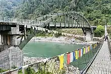 | 3 | Panbang Bridge | 152 m (499 ft) | Arch Steel through arch | Road bridge Manas River | 2013 | Panbang 26°51′10.3″N 90°57′41.3″E / 26.852861°N 90.961472°E | Zhemgang District | [22] |
See also
Notes and references
- Notes
- ↑ The Tamchog Chakzam was washed away in a flood in 1969, he still had his iron chains on that date. For the reconstruction in 2005, four chains were recovered from the river and four others were brought from the dismantled Doksum Chakzam in East Bhutan.[10]
- ↑ The rupture and fall of a glacier into a lake in 1958 created a devastating wave that swept the Mo-Chhu River for miles, taking with it the tree trunks that destroyed the cantilever bridge. The west tower, on the side of the dzong, spared was preserved during the restoration of 2006-2008, the other tower was shifted by 20 metres (66 ft) (the old bridge had a span of 35 metres (115 ft).[13]
- ↑ Also called Paro Dzong Covered Bridge or Nyamai Zam Footbridge.
- ↑ Also called Wangdü, Wangdi or Wandipore Bridge, the date of construction is between 1684 and the mid-18th century,[3][6] its span has been reported from 112 to 180 feet (34.1 to 54.9 m).[5][6]
- ↑ The bridge was mentioned by John Claude White during his expedition in Bhutan between 1887 and 1908.[17]
- ↑ Rebuilt in 2021.[18]
- Nicolas Janberg. "International Database for Civil and Structural Engineering". Structurae.com.
- Others references
- ↑ Gerard, 1841, p.35
- ↑ Deloche, 1984, p.72
- 1 2 3 Bhutanese Bazams or Wooden Cantilever Bridges (Text) and their Development (Drawing) (PDF). 2011. Archived from the original on June 9, 2019.
{{cite book}}:|website=ignored (help) - 1 2 Gerner, 2007, p.60
- 1 2 3 Turner, 1800, p.132
- 1 2 3 4 "Stamps On Bridges of Bhutan". Bhutanphilately.blogspot.fr. 8 July 2010. Retrieved 9 December 2022.
- ↑ "Reconstruction of wooden bridge in Punakha, Bhutan". Waltgalmarini.ch. Retrieved December 9, 2022.
- 1 2 "Reconstruction of Changjiji Bazam". Civilengbt.com. Retrieved December 9, 2022.
- ↑ Kalmus, 2015, p.21
- 1 2 3 Kalmus, 2015, p.27
- ↑ Gerner, 2007, p.97-98
- ↑ Gerner, 2007, p.99
- 1 2 Nestroy, Harald N. (2008). The new Cantilever Bridge of Punakha in the Kingdom of Bhutan (PDF). Archived from the original (PDF) on November 19, 2021.
{{cite book}}:|website=ignored (help) - ↑ Kübler, Wolfram (2007). "Rekonstruktion einer traditionellen Kragbrücke in Punakha, Bhutan" [Reconstruction of a traditional cantilever bridge in Punakha, Bhutan] (PDF). proBhutan.com (in German). Zürich: WaltGalmarini AG. Archived from the original (PDF) on June 22, 2016. Retrieved December 9, 2022.
- 1 2 "Paro Dzongkga, Punakha Dzongkha and Thimphu Dzongkha". Atawalk.net. Retrieved 9 December 2022.
- ↑ Aris, 1982, p.108
- ↑ White, John Claude (1909). . . London: Edward Arnold. p. 134 – via Wikisource.
- 1 2 "New Changjiji Bazam opens". Kuenselonline.com. May 10, 2021. Retrieved December 9, 2022.
- ↑ "Newsletter - Ministry of Works and Human Settlement" (PDF). Mowhs.gov.bt. Vol. 1, no. 1. 2018–2019. Retrieved December 9, 2022.
- ↑ "Much awaited Amochhu bridge finally inaugurated". Bbs.bt. July 14, 2018. Retrieved December 9, 2022.
- ↑ Proposal of Detailed Survey on Diana Kuephen zam Bridge, p.120
- ↑ "Why Bhutan so strict about entry of Indians?". Nenow.in. Retrieved December 9, 2022.
Further reading
- Aris, Michael (1982). Views of Medieval Bhutan, The Diary and Drawings of Samuel Davis - 1783. Washington D.C.: Smithsonian Institution Press. ISBN 0-87474-210-2.
- Deloche, Jean (1984). The Ancient Bridges of India. New Delhi: Sitaram Bhartia Institute of Scientific Research.
- Gerard, Alexander (1841). Account of Koonawur in the Himalaya, Etc. ... London: James Madden.
- Gerner, Manfred (2007). Thangtong Gyalpo: Architect, Philosopher and Iron Chain Bridge Builder (PDF). Translated by Verhufen, Gregor. Centre for Bhutan Studies. ISBN 978-99936-14-39-5.
{{cite book}}:|website=ignored (help) - Kalmus, Marek (November 2015). "Remarks on selected bridges of Thangtong Gyalpo". Journal of Comparative Cultural Studies in Architecture. ResearchGate (Report). pp. 20–32.
- Stearns, Cyrus (2007). King of the Empty Plain: The Tibetan Iron Bridge Builder Tangtong Gyalpo. Boston: Shambhala Publications. ISBN 978-1-5593-9837-4.
- Turner, Samuel (1800). An Account of an Embassy to the Court of the Teshoo Lama in Tibet: Containing a Narrative of a Journey Through Bootan, and Part of Tibet. London: W. Bulmer and Co.
External links
- "Des Ponts couverts en Asie" [Covered Bridges in Asia]. Timbresponts.fr (in French).
- "Stamps On Bridges of Bhutan". Bhutanphilately.blogspot.fr. July 8, 2010.
- "Bridges Map of Wangdue Phodrang District - scale :1:300 000" (PDF). Nsb.gov.bt - National Statistics Bureau. Archived from the original (PDF) on November 16, 2020.
- "Bridges table of Wangdue Phodrang District". Nsb.gov.bt - National Statistics Bureau. Archived from the original (xls) on November 16, 2020.
- Rosenberg, Katrin (August 2009). Good Governance in Bridge Building, Suspension Bridge Programme - Sharing Experiences from Bhutan. Helvetas Bhutan.
- Data collection survey on road connectivity in the Kingdom of Bhutan (PDF). Openjicareport.jica.go.jp - Japan International Cooperation Agency (Report). September 2014.
- "Arch Bridges - Bhutan". Yokogawa-bridge.co.jp.
