Mehran
Persian: مهران | |
|---|---|
City | |
 Mehran  Mehran | |
| Coordinates: 33°07′15″N 46°09′51″E / 33.12083°N 46.16417°E[1] | |
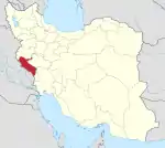
| Country | |
| Province | Ilam |
| County | Mehran |
| District | Central |
| Population (2016)[2] | |
| • Total | 17,435 |
| Time zone | UTC+3:30 (IRST) |
Mehran (Persian: مهران, also Romanized as Mehrān; formerly, Mansurabad (Persian: منصورآباد), also Romanized as Mansūrābād)[3] is a city in the Central District of Mehran County, Ilam province, Iran, and serves as both capital of the county and of the district.
Mehran is located near Iran's western border with Iraq. Because of its strategic proximity - only two hours' drive from Baghdad - the city has played a continuing role in dealings between Iran and Iraq.
In May 1981, during the Iran–Iraq War, Iraqi forces captured Mehran, on the western plain of the Zagros Mountains in Ilam Province, and pushed eastward to the mountain base.[4] Along with other Iraqi forces, they had been driven out by 1982-83.
Demographics
At the 2006 National Census, its population was 13,118 in 2,958 households.[5] The following census in 2011 counted 14,920 people in 3,745 households.[6] The latest census in 2016 showed a population of 17,435 people in 5,019 households.[2]
The city is mostly populated by Kurds with a small Luri minority.[7]
Climate
Mehran has a hot semi-arid climate (Köppen BSh).
| Climate data for Mehran | |||||||||||||
|---|---|---|---|---|---|---|---|---|---|---|---|---|---|
| Month | Jan | Feb | Mar | Apr | May | Jun | Jul | Aug | Sep | Oct | Nov | Dec | Year |
| Mean daily maximum °C (°F) | 15.1 (59.2) |
17.5 (63.5) |
23.5 (74.3) |
29.4 (84.9) |
36.5 (97.7) |
41.8 (107.2) |
44.1 (111.4) |
44.3 (111.7) |
40.0 (104.0) |
33.3 (91.9) |
22.6 (72.7) |
17.0 (62.6) |
30.4 (86.8) |
| Daily mean °C (°F) | 10.2 (50.4) |
12.2 (54.0) |
17.6 (63.7) |
23.4 (74.1) |
30.2 (86.4) |
35.4 (95.7) |
37.8 (100.0) |
37.8 (100.0) |
33.2 (91.8) |
27.0 (80.6) |
17.1 (62.8) |
12.0 (53.6) |
24.5 (76.1) |
| Mean daily minimum °C (°F) | 5.3 (41.5) |
6.6 (43.9) |
10.8 (51.4) |
16.0 (60.8) |
22.0 (71.6) |
27.3 (81.1) |
30.0 (86.0) |
29.7 (85.5) |
25.3 (77.5) |
20.1 (68.2) |
11.7 (53.1) |
7.2 (45.0) |
17.7 (63.8) |
| Average precipitation mm (inches) | 52 (2.0) |
39 (1.5) |
38 (1.5) |
24 (0.9) |
6 (0.2) |
0 (0) |
0 (0) |
0 (0) |
0 (0) |
9 (0.4) |
42 (1.7) |
46 (1.8) |
256 (10) |
| Average precipitation days (≥ 1.0 mm) | 5 | 4 | 4 | 3 | 1 | 0 | 0 | 0 | 0 | 1 | 3 | 4 | 25 |
| Average relative humidity (%) | 64 | 58 | 37 | 29 | 17 | 12 | 12 | 12 | 15 | 22 | 46 | 60 | 32 |
| Source: https://en.climate-data.org/asia/iran/ilam/mehran-50574/ | |||||||||||||
Economy
Border trade
In December 2022 Mehran border market accounts for 23 percent of Iran' total exports to Iraq.[8]
See also
References
- ↑ OpenStreetMap contributors (7 June 2023). "Mehran, Mehran County" (Map). OpenStreetMap. Retrieved 7 June 2023.
- 1 2 "Census of the Islamic Republic of Iran, 1395 (2016)". AMAR (in Persian). The Statistical Center of Iran. p. 16. Archived from the original (Excel) on 1 November 2020. Retrieved 19 December 2022.
- ↑ Mehran, Ilam can be found at GEOnet Names Server, at this link, by opening the Advanced Search box, entering "-3074669" in the "Unique Feature Id" form, and clicking on "Search Database".
- ↑ Iran–Iraq War history.
- ↑ "Census of the Islamic Republic of Iran, 1385 (2006)". AMAR (in Persian). The Statistical Center of Iran. p. 16. Archived from the original (Excel) on 20 September 2011. Retrieved 25 September 2022.
- ↑ "Census of the Islamic Republic of Iran, 1390 (2011)" (Excel). Iran Data Portal (in Persian). The Statistical Center of Iran. p. 16. Retrieved 19 December 2022.
- ↑ "Language distribution: Ilam Province - Mērān". Iran Atlas. Retrieved 27 December 2020.
- ↑ "یک میلیارد و ۸۹ میلیون دلار کالا از مرز مهران به عراق صادر شد". 12 December 2022.
External links
- Iran–Iraq War
- People's militia
- News site
- Investigations about population movements
- News about immigration
- News site
Ilam province, Iran | ||||||||||||||||||||||||
|---|---|---|---|---|---|---|---|---|---|---|---|---|---|---|---|---|---|---|---|---|---|---|---|---|
Capital: Ilam | ||||||||||||||||||||||||
| Counties and cities |
|  | ||||||||||||||||||||||
| Sights |
| |||||||||||||||||||||||
| Populated places | ||||||||||||||||||||||||
| Capital | |||||||||||||||||
|---|---|---|---|---|---|---|---|---|---|---|---|---|---|---|---|---|---|
| Districts |
| ||||||||||||||||