Saint-Étienne-de-Fontbellon | |
|---|---|
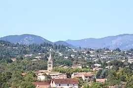 A general view of Saint-Étienne-de-Fontbellon | |
Location of Saint-Étienne-de-Fontbellon | |
 Saint-Étienne-de-Fontbellon  Saint-Étienne-de-Fontbellon | |
| Coordinates: 44°36′06″N 4°23′14″E / 44.6017°N 4.3872°E | |
| Country | France |
| Region | Auvergne-Rhône-Alpes |
| Department | Ardèche |
| Arrondissement | Largentière |
| Canton | Aubenas-2 |
| Government | |
| • Mayor (2020–2026) | Philippe Roux[1] |
| Area 1 | 9.51 km2 (3.67 sq mi) |
| Population | 2,868 |
| • Density | 300/km2 (780/sq mi) |
| Time zone | UTC+01:00 (CET) |
| • Summer (DST) | UTC+02:00 (CEST) |
| INSEE/Postal code | 07231 /07200 |
| Elevation | 167–406 m (548–1,332 ft) (avg. 216 m or 709 ft) |
| 1 French Land Register data, which excludes lakes, ponds, glaciers > 1 km2 (0.386 sq mi or 247 acres) and river estuaries. | |
Saint-Étienne-de-Fontbellon (French pronunciation: [sɛ̃.t‿etjɛn də fɔ̃bɛlɔ̃]; Occitan: Sant Estève de Fontbelon) is a commune in the Ardèche department in southern France.
Population
| Year | Pop. | ±% p.a. |
|---|---|---|
| 1968 | 1,163 | — |
| 1975 | 1,603 | +4.69% |
| 1982 | 1,906 | +2.50% |
| 1990 | 2,143 | +1.48% |
| 1999 | 2,297 | +0.77% |
| 2007 | 2,483 | +0.98% |
| 2012 | 2,531 | +0.38% |
| 2017 | 2,717 | +1.43% |
| Source: INSEE[3] | ||
See also
References
- ↑ "Répertoire national des élus: les maires". data.gouv.fr, Plateforme ouverte des données publiques françaises (in French). 9 August 2021.
- ↑ "Populations légales 2021". The National Institute of Statistics and Economic Studies. 28 December 2023.
- ↑ Population en historique depuis 1968, INSEE
External links
Wikimedia Commons has media related to Saint-Étienne-de-Fontbellon.
This article is issued from Wikipedia. The text is licensed under Creative Commons - Attribution - Sharealike. Additional terms may apply for the media files.