Saint-Barthélemy-le-Meil | |
|---|---|
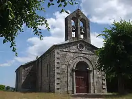 The church in Saint-Barthélemy-le-Meil | |
Location of Saint-Barthélemy-le-Meil | |
 Saint-Barthélemy-le-Meil  Saint-Barthélemy-le-Meil | |
| Coordinates: 44°53′08″N 4°29′56″E / 44.8856°N 4.4989°E | |
| Country | France |
| Region | Auvergne-Rhône-Alpes |
| Department | Ardèche |
| Arrondissement | Tournon-sur-Rhône |
| Canton | Haut-Eyrieux |
| Government | |
| • Mayor (2022–2026) | Céline Sausse[1] |
| Area 1 | 7.35 km2 (2.84 sq mi) |
| Population | 202 |
| • Density | 27/km2 (71/sq mi) |
| Time zone | UTC+01:00 (CET) |
| • Summer (DST) | UTC+02:00 (CEST) |
| INSEE/Postal code | 07215 /07160 |
| Elevation | 340–800 m (1,120–2,620 ft) (avg. 500 m or 1,600 ft) |
| 1 French Land Register data, which excludes lakes, ponds, glaciers > 1 km2 (0.386 sq mi or 247 acres) and river estuaries. | |
Saint-Barthélemy-le-Meil (French pronunciation: [sɛ̃ baʁtelemi lə mɛj]; Occitan: Sant Bartomieu Amelh) is a commune in the Ardèche department in southern France.
Population
| Year | Pop. | ±% p.a. |
|---|---|---|
| 1968 | 285 | — |
| 1975 | 239 | −2.48% |
| 1982 | 229 | −0.61% |
| 1990 | 223 | −0.33% |
| 1999 | 222 | −0.05% |
| 2009 | 211 | −0.51% |
| 2014 | 197 | −1.36% |
| 2020 | 201 | +0.34% |
| Source: INSEE[3] | ||
See also
References
- ↑ "Répertoire national des élus: les maires" (in French). data.gouv.fr, Plateforme ouverte des données publiques françaises. 6 June 2023.
- ↑ "Populations légales 2021". The National Institute of Statistics and Economic Studies. 28 December 2023.
- ↑ Population en historique depuis 1968, INSEE
Wikimedia Commons has media related to Saint-Barthélemy-le-Meil.
This article is issued from Wikipedia. The text is licensed under Creative Commons - Attribution - Sharealike. Additional terms may apply for the media files.