Saint-Péray | |
|---|---|
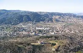 A general view of Saint-Péray | |
 Coat of arms | |
Location of Saint-Péray | |
 Saint-Péray  Saint-Péray | |
| Coordinates: 44°56′58″N 4°50′45″E / 44.9494°N 4.8458°E | |
| Country | France |
| Region | Auvergne-Rhône-Alpes |
| Department | Ardèche |
| Arrondissement | Tournon-sur-Rhône |
| Canton | Guilherand-Granges |
| Government | |
| • Mayor (2020–2026) | Jacques Dubay[1] |
| Area 1 | 24.05 km2 (9.29 sq mi) |
| Population | 7,588 |
| • Density | 320/km2 (820/sq mi) |
| Time zone | UTC+01:00 (CET) |
| • Summer (DST) | UTC+02:00 (CEST) |
| INSEE/Postal code | 07281 /07130 |
| Elevation | 107–652 m (351–2,139 ft) (avg. 128 m or 420 ft) |
| 1 French Land Register data, which excludes lakes, ponds, glaciers > 1 km2 (0.386 sq mi or 247 acres) and river estuaries. | |
Saint-Péray (French pronunciation: [sɛ̃ peʁɛ] ⓘ; Occitan: Sant Pèire d'Ai) is a commune in the Ardèche department in the Auvergne-Rhône-Alpes region in southern France.
Population
|
| ||||||||||||||||||||||||||||||||||||||||||||||||||||||||||||||||||||||||||||||||||||||||||||||||||||||||||||||||||
| Source: EHESS[3] and INSEE (1968-2020)[4] | |||||||||||||||||||||||||||||||||||||||||||||||||||||||||||||||||||||||||||||||||||||||||||||||||||||||||||||||||||
See also
- Château de Crussol, located on the territory of the commune.
- Communes of the Ardèche department
References
- ↑ "Répertoire national des élus: les maires" (in French). data.gouv.fr, Plateforme ouverte des données publiques françaises. 13 September 2022.
- ↑ "Populations légales 2021". The National Institute of Statistics and Economic Studies. 28 December 2023.
- ↑ Des villages de Cassini aux communes d'aujourd'hui: Commune data sheet Saint-Péray, EHESS (in French).
- ↑ Population en historique depuis 1968, INSEE
Wikimedia Commons has media related to Saint-Péray.
This article is issued from Wikipedia. The text is licensed under Creative Commons - Attribution - Sharealike. Additional terms may apply for the media files.