Saint-Rémy-de-Chaudes-Aigues
| |
|---|---|
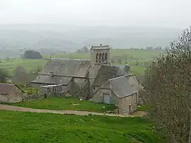 Église Saint-Rémi | |
Location of Saint-Rémy-de-Chaudes-Aigues | |
 Saint-Rémy-de-Chaudes-Aigues  Saint-Rémy-de-Chaudes-Aigues | |
| Coordinates: 44°46′34″N 3°01′54″E / 44.7761°N 3.0317°E | |
| Country | France |
| Region | Auvergne-Rhône-Alpes |
| Department | Cantal |
| Arrondissement | Saint-Flour |
| Canton | Neuvéglise-sur-Truyère |
| Intercommunality | Saint-Flour Communauté |
| Government | |
| • Mayor (2020–2026) | Vital Gendre[1] |
| Area 1 | 14.87 km2 (5.74 sq mi) |
| Population | 123 |
| • Density | 8.3/km2 (21/sq mi) |
| Time zone | UTC+01:00 (CET) |
| • Summer (DST) | UTC+02:00 (CEST) |
| INSEE/Postal code | 15209 /15110 |
| Elevation | 951–1,282 m (3,120–4,206 ft) (avg. 1,050 m or 3,440 ft) |
| 1 French Land Register data, which excludes lakes, ponds, glaciers > 1 km2 (0.386 sq mi or 247 acres) and river estuaries. | |
Saint-Rémy-de-Chaudes-Aigues (French pronunciation: [sɛ̃ ʁemi də ʃod.z‿ɛɡ], lit. "Saint-Rémy of Chaudes-Aigues"; Occitan: Sent Remise de Chaldas Aigas) is a commune in the Cantal department in the Auvergne-Rhône-Alpes region in south-central France.
Demographics
| Year | Pop. | ±% p.a. |
|---|---|---|
| 1968 | 180 | — |
| 1975 | 153 | −2.29% |
| 1982 | 142 | −1.06% |
| 1990 | 132 | −0.91% |
| 1999 | 118 | −1.24% |
| 2009 | 112 | −0.52% |
| 2014 | 115 | +0.53% |
| 2020 | 123 | +1.13% |
| Source: INSEE[3] | ||
See also
References
- ↑ "Répertoire national des élus: les maires" (in French). data.gouv.fr, Plateforme ouverte des données publiques françaises. 13 September 2022.
- ↑ "Populations légales 2021". The National Institute of Statistics and Economic Studies. 28 December 2023.
- ↑ Population en historique depuis 1968, INSEE
Wikimedia Commons has media related to Saint-Rémy-de-Chaudes-Aigues.
This article is issued from Wikipedia. The text is licensed under Creative Commons - Attribution - Sharealike. Additional terms may apply for the media files.