Saint-Victor | |
|---|---|
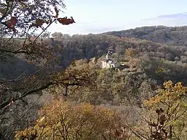 A general view of Saint-Victor | |
Location of Saint-Victor | |
 Saint-Victor  Saint-Victor | |
| Coordinates: 45°00′39″N 2°17′19″E / 45.0108°N 2.2886°E | |
| Country | France |
| Region | Auvergne-Rhône-Alpes |
| Department | Cantal |
| Arrondissement | Aurillac |
| Canton | Saint-Paul-des-Landes |
| Government | |
| • Mayor (2020–2026) | Michel Teyssou[1] |
| Area 1 | 13.53 km2 (5.22 sq mi) |
| Population | 101 |
| • Density | 7.5/km2 (19/sq mi) |
| Time zone | UTC+01:00 (CET) |
| • Summer (DST) | UTC+02:00 (CEST) |
| INSEE/Postal code | 15217 /15150 |
| Elevation | 440–652 m (1,444–2,139 ft) (avg. 600 m or 2,000 ft) |
| 1 French Land Register data, which excludes lakes, ponds, glaciers > 1 km2 (0.386 sq mi or 247 acres) and river estuaries. | |
Saint-Victor (French pronunciation: [sɛ̃ viktɔʁ]; Auvergnat: Sant Victor) is a commune in the Cantal department in south-central France.
Population
| Year | Pop. | ±% |
|---|---|---|
| 1962 | 125 | — |
| 1968 | 152 | +21.6% |
| 1975 | 120 | −21.1% |
| 1982 | 141 | +17.5% |
| 1990 | 135 | −4.3% |
| 1999 | 127 | −5.9% |
| 2008 | 108 | −15.0% |
| 2016 | 109 | +0.9% |
See also
References
- ↑ "Répertoire national des élus: les maires". data.gouv.fr, Plateforme ouverte des données publiques françaises (in French). 9 August 2021.
- ↑ "Populations légales 2021". The National Institute of Statistics and Economic Studies. 28 December 2023.
Wikimedia Commons has media related to Saint-Victor (Cantal).
This article is issued from Wikipedia. The text is licensed under Creative Commons - Attribution - Sharealike. Additional terms may apply for the media files.