Antezant-la-Chapelle | |
|---|---|
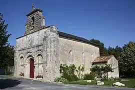 The church in Antezant-la-Chapelle | |
Location of Antezant-la-Chapelle | |
 Antezant-la-Chapelle  Antezant-la-Chapelle | |
| Coordinates: 45°59′00″N 0°27′18″W / 45.9833°N 0.455°W | |
| Country | France |
| Region | Nouvelle-Aquitaine |
| Department | Charente-Maritime |
| Arrondissement | Saint-Jean-d'Angély |
| Canton | Matha |
| Government | |
| • Mayor (2020–2026) | Eric Poisbelaud[1] |
| Area 1 | 18.63 km2 (7.19 sq mi) |
| Population | 357 |
| • Density | 19/km2 (50/sq mi) |
| Time zone | UTC+01:00 (CET) |
| • Summer (DST) | UTC+02:00 (CEST) |
| INSEE/Postal code | 17013 /17400 |
| Elevation | 18–89 m (59–292 ft) (avg. 30 m or 98 ft) |
| 1 French Land Register data, which excludes lakes, ponds, glaciers > 1 km2 (0.386 sq mi or 247 acres) and river estuaries. | |
Antezant-la-Chapelle (French pronunciation: [ɑ̃tzɑ̃ la ʃapɛl]) is a commune in the Charente-Maritime department in the Nouvelle-Aquitaine region in southwestern France.
Geography
The river Boutonne forms most of the commune's eastern border.
Population
| Year | Pop. | ±% p.a. |
|---|---|---|
| 1968 | 383 | — |
| 1975 | 333 | −1.98% |
| 1982 | 352 | +0.80% |
| 1990 | 353 | +0.04% |
| 1999 | 339 | −0.45% |
| 2009 | 357 | +0.52% |
| 2014 | 361 | +0.22% |
| 2020 | 348 | −0.61% |
| Source: INSEE[3] | ||
See also
References
- ↑ "Répertoire national des élus: les maires". data.gouv.fr, Plateforme ouverte des données publiques françaises (in French). 2 December 2020.
- ↑ "Populations légales 2021". The National Institute of Statistics and Economic Studies. 28 December 2023.
- ↑ Population en historique depuis 1968, INSEE
External links
 Media related to Antezant-la-Chapelle at Wikimedia Commons
This article is issued from Wikipedia. The text is licensed under Creative Commons - Attribution - Sharealike. Additional terms may apply for the media files.