Sainte-Radegonde | |
|---|---|
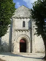 The church in Sainte-Radegonde | |
Location of Sainte-Radegonde | |
 Sainte-Radegonde  Sainte-Radegonde | |
| Coordinates: 45°50′51″N 0°52′24″W / 45.8475°N 0.8733°W | |
| Country | France |
| Region | Nouvelle-Aquitaine |
| Department | Charente-Maritime |
| Arrondissement | Saintes |
| Canton | Saint-Porchaire |
| Government | |
| • Mayor (2020–2026) | Monique Rivière[1] |
| Area 1 | 11.14 km2 (4.30 sq mi) |
| Population | 578 |
| • Density | 52/km2 (130/sq mi) |
| Time zone | UTC+01:00 (CET) |
| • Summer (DST) | UTC+02:00 (CEST) |
| INSEE/Postal code | 17389 /17250 |
| Elevation | 2–35 m (6.6–114.8 ft) (avg. 50 m or 160 ft) |
| 1 French Land Register data, which excludes lakes, ponds, glaciers > 1 km2 (0.386 sq mi or 247 acres) and river estuaries. | |
Sainte-Radegonde (French pronunciation: [sɛ̃t ʁadɡɔ̃d]) is a commune in the Charente-Maritime department in southwestern France.
Population
| Year | Pop. | ±% |
|---|---|---|
| 1962 | 246 | — |
| 1968 | 248 | +0.8% |
| 1975 | 270 | +8.9% |
| 1982 | 302 | +11.9% |
| 1990 | 369 | +22.2% |
| 1999 | 382 | +3.5% |
| 2007 | 465 | +21.7% |
See also
References
- ↑ "Répertoire national des élus: les maires". data.gouv.fr, Plateforme ouverte des données publiques françaises (in French). 2 December 2020.
- ↑ "Populations légales 2021". The National Institute of Statistics and Economic Studies. 28 December 2023.
External links
 Media related to Sainte-Radegonde (Charente-Maritime) at Wikimedia Commons
This article is issued from Wikipedia. The text is licensed under Creative Commons - Attribution - Sharealike. Additional terms may apply for the media files.