Blanzay-sur-Boutonne | |
|---|---|
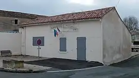 The town hall in Blanzay-sur-Boutonne | |
Location of Blanzay-sur-Boutonne | |
 Blanzay-sur-Boutonne  Blanzay-sur-Boutonne | |
| Coordinates: 46°03′02″N 0°25′42″W / 46.0506°N 0.4283°W | |
| Country | France |
| Region | Nouvelle-Aquitaine |
| Department | Charente-Maritime |
| Arrondissement | Saint-Jean-d'Angély |
| Canton | Matha |
| Intercommunality | Vals de Saintonge |
| Government | |
| • Mayor (2020–2026) | Jean-Luc Duguy[1] |
| Area 1 | 5.75 km2 (2.22 sq mi) |
| Population | 77 |
| • Density | 13/km2 (35/sq mi) |
| Time zone | UTC+01:00 (CET) |
| • Summer (DST) | UTC+02:00 (CEST) |
| INSEE/Postal code | 17049 /17470 |
| Elevation | 26–57 m (85–187 ft) |
| 1 French Land Register data, which excludes lakes, ponds, glaciers > 1 km2 (0.386 sq mi or 247 acres) and river estuaries. | |
Blanzay-sur-Boutonne (French pronunciation: [blɑ̃zɛ syʁ butɔn], literally Blanzay on Boutonne) is a commune in the Charente-Maritime department in the Nouvelle-Aquitaine region in southwestern France.
Geography
The Boutonne forms the commune's northwestern and western borders.
Population
| Year | Pop. | ±% p.a. |
|---|---|---|
| 1968 | 146 | — |
| 1975 | 134 | −1.22% |
| 1982 | 105 | −3.42% |
| 1990 | 83 | −2.90% |
| 1999 | 86 | +0.40% |
| 2009 | 95 | +1.00% |
| 2014 | 88 | −1.52% |
| 2020 | 78 | −1.99% |
| Source: INSEE[3] | ||
See also
References
- ↑ "Répertoire national des élus: les maires". data.gouv.fr, Plateforme ouverte des données publiques françaises (in French). 2 December 2020.
- ↑ "Populations légales 2021". The National Institute of Statistics and Economic Studies. 28 December 2023.
- ↑ Population en historique depuis 1968, INSEE
External links
 Media related to Blanzay-sur-Boutonne at Wikimedia Commons
This article is issued from Wikipedia. The text is licensed under Creative Commons - Attribution - Sharealike. Additional terms may apply for the media files.