Saint Césaire | |
|---|---|
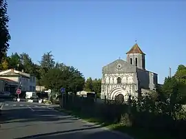 The church in Saint-Césaire | |
Location of Saint Césaire | |
 Saint Césaire  Saint Césaire | |
| Coordinates: 45°45′11″N 0°30′22″W / 45.7531°N 0.5061°W | |
| Country | France |
| Region | Nouvelle-Aquitaine |
| Department | Charente-Maritime |
| Arrondissement | Saintes |
| Canton | Chaniers |
| Intercommunality | CA Saintes |
| Government | |
| • Mayor (2020–2026) | Mireille André[1] |
| Area 1 | 10.41 km2 (4.02 sq mi) |
| Population | 895 |
| • Density | 86/km2 (220/sq mi) |
| Time zone | UTC+01:00 (CET) |
| • Summer (DST) | UTC+02:00 (CEST) |
| INSEE/Postal code | 17314 /17770 |
| Elevation | 22–89 m (72–292 ft) (avg. 30 m or 98 ft) |
| 1 French Land Register data, which excludes lakes, ponds, glaciers > 1 km2 (0.386 sq mi or 247 acres) and river estuaries. | |
Saint-Césaire (French pronunciation: [sɛ̃ sezɛʁ]) is a commune in the Charente-Maritime department, administrative region of Nouvelle-Aquitaine (before 2015: Poitou-Charentes), southwestern France. In the 1970s, a Neanderthal skeleton was found near Saint-Césaire.[3]
Population
| Year | Pop. | ±% |
|---|---|---|
| 1962 | 543 | — |
| 1968 | 619 | +14.0% |
| 1975 | 717 | +15.8% |
| 1982 | 830 | +15.8% |
| 1990 | 858 | +3.4% |
| 1999 | 888 | +3.5% |
| 2008 | 918 | +3.4% |
See also
References
- ↑ "Répertoire national des élus: les maires". data.gouv.fr, Plateforme ouverte des données publiques françaises (in French). 9 August 2021.
- ↑ "Populations légales 2021". The National Institute of Statistics and Economic Studies. 28 December 2023.
- ↑ Paléosite Archived 2014-02-02 at the Wayback Machine
External links
 Media related to Saint-Césaire (Charente-Maritime) at Wikimedia Commons
This article is issued from Wikipedia. The text is licensed under Creative Commons - Attribution - Sharealike. Additional terms may apply for the media files.