Berneuil | |
|---|---|
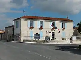 The town hall in Berneuil | |
Location of Berneuil | |
 Berneuil  Berneuil | |
| Coordinates: 45°38′38″N 0°35′57″W / 45.6439°N 0.5992°W | |
| Country | France |
| Region | Nouvelle-Aquitaine |
| Department | Charente-Maritime |
| Arrondissement | Saintes |
| Canton | Thénac |
| Intercommunality | Gémozac et la Saintonge Viticole |
| Government | |
| • Mayor (2020–2026) | Jean-Pierre Maurel[1] |
| Area 1 | 25.45 km2 (9.83 sq mi) |
| Population | 1,162 |
| • Density | 46/km2 (120/sq mi) |
| Time zone | UTC+01:00 (CET) |
| • Summer (DST) | UTC+02:00 (CEST) |
| INSEE/Postal code | 17044 /17460 |
| Elevation | 5–72 m (16–236 ft) |
| 1 French Land Register data, which excludes lakes, ponds, glaciers > 1 km2 (0.386 sq mi or 247 acres) and river estuaries. | |
Berneuil (French pronunciation: [bɛʁnœj]) is a commune in the Charente-Maritime department in southwestern France.
Geography
The Seugne forms part of the commune's northeastern border.
Population
| Year | Pop. | ±% p.a. |
|---|---|---|
| 1968 | 636 | — |
| 1975 | 595 | −0.95% |
| 1982 | 669 | +1.69% |
| 1990 | 732 | +1.13% |
| 1999 | 836 | +1.49% |
| 2009 | 1,053 | +2.33% |
| 2014 | 1,146 | +1.71% |
| 2020 | 1,149 | +0.04% |
| Source: INSEE[3] | ||
See also
References
- ↑ "Répertoire national des élus: les maires" (in French). data.gouv.fr, Plateforme ouverte des données publiques françaises. 13 September 2022.
- ↑ "Populations légales 2021". The National Institute of Statistics and Economic Studies. 28 December 2023.
- ↑ Population en historique depuis 1968, INSEE
External links
 Media related to Berneuil (Charente-Maritime) at Wikimedia Commons
This article is issued from Wikipedia. The text is licensed under Creative Commons - Attribution - Sharealike. Additional terms may apply for the media files.