Bedenac | |
|---|---|
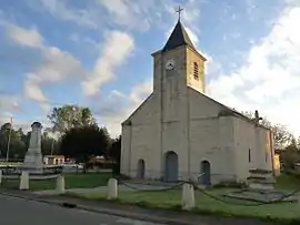 The church in Bedenac | |
.svg.png.webp) Coat of arms | |
Location of Bedenac | |
 Bedenac  Bedenac | |
| Coordinates: 45°09′54″N 0°18′20″W / 45.165°N 0.3055°W | |
| Country | France |
| Region | Nouvelle-Aquitaine |
| Department | Charente-Maritime |
| Arrondissement | Jonzac |
| Canton | Les Trois Monts |
| Government | |
| • Mayor (2020–2026) | Alain Laparliere[1] |
| Area 1 | 40.23 km2 (15.53 sq mi) |
| Population | 690 |
| • Density | 17/km2 (44/sq mi) |
| Time zone | UTC+01:00 (CET) |
| • Summer (DST) | UTC+02:00 (CEST) |
| INSEE/Postal code | 17038 /17220 |
| Elevation | 44–109 m (144–358 ft) (avg. 60 m or 200 ft) |
| 1 French Land Register data, which excludes lakes, ponds, glaciers > 1 km2 (0.386 sq mi or 247 acres) and river estuaries. | |
Bedenac (French pronunciation: [bedənak]; also Bédenac) is a commune in the Charente-Maritime in the department in the Nouvelle-Aquitaine region in southwestern France. It is one of the largest communes in the department, in terms of land area.
Population
| Year | Pop. | ±% |
|---|---|---|
| 1962 | 397 | — |
| 1968 | 475 | +19.6% |
| 1975 | 437 | −8.0% |
| 1982 | 431 | −1.4% |
| 1990 | 494 | +14.6% |
| 1999 | 509 | +3.0% |
| 2008 | 595 | +16.9% |
See also
References
- ↑ "Répertoire national des élus: les maires". data.gouv.fr, Plateforme ouverte des données publiques françaises (in French). 9 August 2021.
- ↑ "Populations légales 2021". The National Institute of Statistics and Economic Studies. 28 December 2023.
External links
 Media related to Bedenac at Wikimedia Commons
This article is issued from Wikipedia. The text is licensed under Creative Commons - Attribution - Sharealike. Additional terms may apply for the media files.