Cabrerolles | |
|---|---|
.svg.png.webp) Coat of arms | |
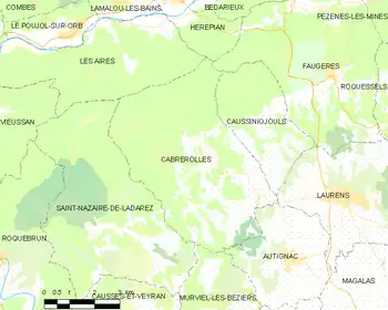
Location of Cabrerolles | |
 Cabrerolles  Cabrerolles | |
| Coordinates: 43°32′45″N 3°07′34″E / 43.5458°N 3.1261°E | |
| Country | France |
| Region | Occitania |
| Department | Hérault |
| Arrondissement | Béziers |
| Canton | Cazouls-lès-Béziers |
| Intercommunality | Les Avant-Monts |
| Government | |
| • Mayor (2020–2026) | Séverine Saur[1] |
| Area 1 | 28.68 km2 (11.07 sq mi) |
| Population | 337 |
| • Density | 12/km2 (30/sq mi) |
| Time zone | UTC+01:00 (CET) |
| • Summer (DST) | UTC+02:00 (CEST) |
| INSEE/Postal code | 34044 /34480 |
| Elevation | 134–705 m (440–2,313 ft) (avg. 310 m or 1,020 ft) |
| 1 French Land Register data, which excludes lakes, ponds, glaciers > 1 km2 (0.386 sq mi or 247 acres) and river estuaries. | |
Cabrerolles (French pronunciation: [kabʁəʁɔl]; Languedocien: Cabrairòlas) is a commune in the Hérault department in southern France.
Winemaking
Cabrerolles is one of the seven communes which produces Faugères AOC wine. As well as the main village, it has three hamlets, Lentheric, Liquière and Aigues-Vives, which all produce wine.
Population
| Year | Pop. | ±% p.a. |
|---|---|---|
| 1968 | 284 | — |
| 1975 | 256 | −1.47% |
| 1982 | 255 | −0.06% |
| 1990 | 293 | +1.75% |
| 1999 | 270 | −0.90% |
| 2007 | 334 | +2.69% |
| 2012 | 349 | +0.88% |
| 2017 | 335 | −0.82% |
| Source: INSEE[3] | ||
Map
See also
References
- ↑ "Répertoire national des élus: les maires" (in French). data.gouv.fr, Plateforme ouverte des données publiques françaises. 13 September 2022.
- ↑ "Populations légales 2021". The National Institute of Statistics and Economic Studies. 28 December 2023.
- ↑ Population en historique depuis 1968, INSEE
Wikimedia Commons has media related to Cabrerolles.
This article is issued from Wikipedia. The text is licensed under Creative Commons - Attribution - Sharealike. Additional terms may apply for the media files.