Colombières-sur-Orb | |
|---|---|
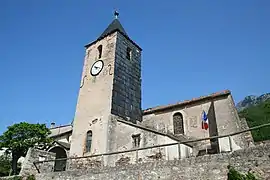 Saint-Pierre Church | |
.svg.png.webp) Coat of arms | |
Location of Colombières-sur-Orb | |
 Colombières-sur-Orb  Colombières-sur-Orb | |
| Coordinates: 43°34′52″N 3°00′38″E / 43.5811°N 3.0106°E | |
| Country | France |
| Region | Occitania |
| Department | Hérault |
| Arrondissement | Béziers |
| Canton | Saint-Pons-de-Thomières |
| Intercommunality | CC du Minervois au Caroux |
| Government | |
| • Mayor (2020–2026) | Thérèse Salavin[1] |
| Area 1 | 8.11 km2 (3.13 sq mi) |
| Population | 480 |
| • Density | 59/km2 (150/sq mi) |
| Time zone | UTC+01:00 (CET) |
| • Summer (DST) | UTC+02:00 (CEST) |
| INSEE/Postal code | 34080 /34390 |
| Elevation | 132–1,008 m (433–3,307 ft) |
| 1 French Land Register data, which excludes lakes, ponds, glaciers > 1 km2 (0.386 sq mi or 247 acres) and river estuaries. | |
Colombières-sur-Orb (French pronunciation: [kɔlɔ̃bjɛʁ syʁ ɔʁb], literally Colombières on Orb; Occitan: Colombièiras d'Òrb) is a commune in the Hérault department in southern France.
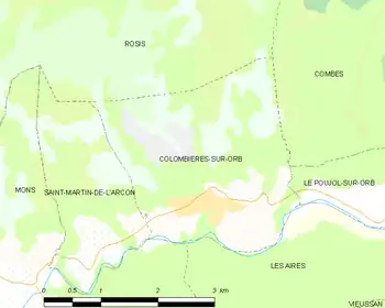
Map
The communal territory is home to a castle and the Gorges de Colombières, part of the Haut-Languedoc Regional Park, which includes prehistoric traces of troglodytes.
Population
| Year | Pop. | ±% p.a. |
|---|---|---|
| 1968 | 266 | — |
| 1975 | 270 | +0.21% |
| 1982 | 339 | +3.30% |
| 1990 | 397 | +1.99% |
| 1999 | 417 | +0.55% |
| 2009 | 464 | +1.07% |
| 2014 | 471 | +0.30% |
| 2020 | 480 | +0.32% |
| Source: INSEE[3] | ||
See also
References
- ↑ "Répertoire national des élus: les maires". data.gouv.fr, Plateforme ouverte des données publiques françaises (in French). 9 August 2021.
- ↑ "Populations légales 2021". The National Institute of Statistics and Economic Studies. 28 December 2023.
- ↑ Population en historique depuis 1968, INSEE
Wikimedia Commons has media related to Colombières-sur-Orb.
This article is issued from Wikipedia. The text is licensed under Creative Commons - Attribution - Sharealike. Additional terms may apply for the media files.