Pardailhan | |
|---|---|
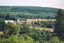 The hamlet of Pardailhan | |
 Coat of arms | |
Location of Pardailhan | |
 Pardailhan  Pardailhan | |
| Coordinates: 43°27′06″N 2°50′50″E / 43.4517°N 2.8472°E | |
| Country | France |
| Region | Occitania |
| Department | Hérault |
| Arrondissement | Béziers |
| Canton | Saint-Pons-de-Thomières |
| Government | |
| • Mayor (2020–2026) | Alain Tailhan[1] |
| Area 1 | 41.18 km2 (15.90 sq mi) |
| Population | 173 |
| • Density | 4.2/km2 (11/sq mi) |
| Time zone | UTC+01:00 (CET) |
| • Summer (DST) | UTC+02:00 (CEST) |
| INSEE/Postal code | 34193 /34360 |
| Elevation | 275–820 m (902–2,690 ft) (avg. 473 m or 1,552 ft) |
| 1 French Land Register data, which excludes lakes, ponds, glaciers > 1 km2 (0.386 sq mi or 247 acres) and river estuaries. | |
Pardailhan (French pronunciation: [paʁdajɑ̃]; Occitan: Pardalhan) is a commune in the Hérault department in the Occitanie region in southern France.
Population
| Year | Pop. | ±% p.a. |
|---|---|---|
| 1968 | 93 | — |
| 1975 | 83 | −1.61% |
| 1982 | 102 | +2.99% |
| 1990 | 126 | +2.68% |
| 1999 | 164 | +2.97% |
| 2009 | 180 | +0.94% |
| 2014 | 185 | +0.55% |
| 2020 | 174 | −1.02% |
| Source: INSEE[3] | ||
See also
References
- ↑ "Répertoire national des élus: les maires". data.gouv.fr, Plateforme ouverte des données publiques françaises (in French). 9 August 2021.
- ↑ "Populations légales 2021". The National Institute of Statistics and Economic Studies. 28 December 2023.
- ↑ Population en historique depuis 1968, INSEE
Wikimedia Commons has media related to Pardailhan.
This article is issued from Wikipedia. The text is licensed under Creative Commons - Attribution - Sharealike. Additional terms may apply for the media files.