Challignac | |
|---|---|
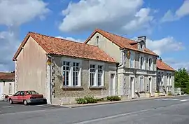 The town hall and school in Challignac | |
Location of Challignac | |
 Challignac  Challignac | |
| Coordinates: 45°24′57″N 0°04′51″W / 45.4158°N 0.0808°W | |
| Country | France |
| Region | Nouvelle-Aquitaine |
| Department | Charente |
| Arrondissement | Cognac |
| Canton | Charente-Sud |
| Government | |
| • Mayor (2020–2026) | Christophe Tutard[1] |
| Area 1 | 13.21 km2 (5.10 sq mi) |
| Population | 339 |
| • Density | 26/km2 (66/sq mi) |
| Time zone | UTC+01:00 (CET) |
| • Summer (DST) | UTC+02:00 (CEST) |
| INSEE/Postal code | 16074 /16300 |
| Elevation | 57–133 m (187–436 ft) (avg. 102 m or 335 ft) |
| 1 French Land Register data, which excludes lakes, ponds, glaciers > 1 km2 (0.386 sq mi or 247 acres) and river estuaries. | |
Challignac (French pronunciation: [ʃaliɲak]) is a commune in the Charente department in southwestern France.
Population
| Year | Pop. | ±% p.a. |
|---|---|---|
| 1968 | 344 | — |
| 1975 | 257 | −4.08% |
| 1982 | 288 | +1.64% |
| 1990 | 327 | +1.60% |
| 1999 | 314 | −0.45% |
| 2009 | 299 | −0.49% |
| 2014 | 324 | +1.62% |
| 2020 | 336 | +0.61% |
| Source: INSEE[3] | ||
See also
References
- ↑ "Répertoire national des élus: les maires". data.gouv.fr, Plateforme ouverte des données publiques françaises (in French). 9 August 2021.
- ↑ "Populations légales 2021". The National Institute of Statistics and Economic Studies. 28 December 2023.
- ↑ Population en historique depuis 1968, INSEE
Wikimedia Commons has media related to Challignac.
This article is issued from Wikipedia. The text is licensed under Creative Commons - Attribution - Sharealike. Additional terms may apply for the media files.