Dignac | |
|---|---|
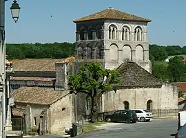 The church in Dignac | |
 Coat of arms | |
Location of Dignac | |
 Dignac  Dignac | |
| Coordinates: 45°33′26″N 0°16′52″E / 45.5572°N 0.2811°E | |
| Country | France |
| Region | Nouvelle-Aquitaine |
| Department | Charente |
| Arrondissement | Angoulême |
| Canton | Boëme-Échelle |
| Intercommunality | Grand Angoulême |
| Government | |
| • Mayor (2020–2026) | Françoise Delage[1] |
| Area 1 | 27.66 km2 (10.68 sq mi) |
| Population | 1,363 |
| • Density | 49/km2 (130/sq mi) |
| Time zone | UTC+01:00 (CET) |
| • Summer (DST) | UTC+02:00 (CEST) |
| INSEE/Postal code | 16119 /16410 |
| Elevation | 105–224 m (344–735 ft) |
| 1 French Land Register data, which excludes lakes, ponds, glaciers > 1 km2 (0.386 sq mi or 247 acres) and river estuaries. | |
Dignac (French pronunciation: [diɲak]; Occitan: Dinhac) is a commune in the Charente department in southwestern France.
Population
| Year | Pop. | ±% p.a. |
|---|---|---|
| 1968 | 843 | — |
| 1975 | 896 | +0.87% |
| 1982 | 1,147 | +3.59% |
| 1990 | 1,230 | +0.88% |
| 1999 | 1,280 | +0.44% |
| 2009 | 1,308 | +0.22% |
| 2014 | 1,329 | +0.32% |
| 2020 | 1,356 | +0.34% |
| Source: INSEE[3] | ||
See also
References
- ↑ "Répertoire national des élus: les maires". data.gouv.fr, Plateforme ouverte des données publiques françaises (in French). 2 December 2020.
- ↑ "Populations légales 2021". The National Institute of Statistics and Economic Studies. 28 December 2023.
- ↑ Population en historique depuis 1968, INSEE
Wikimedia Commons has media related to Dignac.
This article is issued from Wikipedia. The text is licensed under Creative Commons - Attribution - Sharealike. Additional terms may apply for the media files.