Lésignac-Durand | |
|---|---|
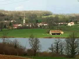 The lake in Lésignac | |
Location of Lésignac-Durand | |
 Lésignac-Durand  Lésignac-Durand | |
| Coordinates: 45°48′44″N 0°38′17″E / 45.8122°N 0.6381°E | |
| Country | France |
| Region | Nouvelle-Aquitaine |
| Department | Charente |
| Arrondissement | Confolens |
| Canton | Charente-Bonnieure |
| Government | |
| • Mayor (2020–2026) | Pascal Duteil[1] |
| Area 1 | 19.74 km2 (7.62 sq mi) |
| Population | 171 |
| • Density | 8.7/km2 (22/sq mi) |
| Time zone | UTC+01:00 (CET) |
| • Summer (DST) | UTC+02:00 (CEST) |
| INSEE/Postal code | 16183 /16310 |
| Elevation | 193–296 m (633–971 ft) (avg. 245 m or 804 ft) |
| 1 French Land Register data, which excludes lakes, ponds, glaciers > 1 km2 (0.386 sq mi or 247 acres) and river estuaries. | |
Lésignac-Durand (French pronunciation: [leziɲak dyʁɑ̃]; Occitan: Lesinhac) is a commune in the Charente department in the Nouvelle-Aquitaine region in southwestern France.
Geography
The commune is found within the Rochechouart impact structure.
Population
| Year | Pop. | ±% p.a. |
|---|---|---|
| 1968 | 399 | — |
| 1975 | 352 | −1.77% |
| 1982 | 299 | −2.30% |
| 1990 | 228 | −3.33% |
| 1999 | 184 | −2.35% |
| 2009 | 183 | −0.05% |
| 2014 | 183 | +0.00% |
| 2020 | 173 | −0.93% |
| Source: INSEE[3] | ||
Personalities
See also
References
- ↑ "Répertoire national des élus: les maires". data.gouv.fr, Plateforme ouverte des données publiques françaises (in French). 2 December 2020.
- ↑ "Populations légales 2021". The National Institute of Statistics and Economic Studies. 28 December 2023.
- ↑ Population en historique depuis 1968, INSEE
Wikimedia Commons has media related to Lésignac-Durand.
This article is issued from Wikipedia. The text is licensed under Creative Commons - Attribution - Sharealike. Additional terms may apply for the media files.