Roussines | |
|---|---|
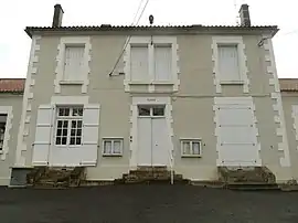 The town hall in Roussines | |
.svg.png.webp) Coat of arms | |
Location of Roussines | |
 Roussines  Roussines | |
| Coordinates: 45°43′26″N 0°37′16″E / 45.7239°N 0.6211°E | |
| Country | France |
| Region | Nouvelle-Aquitaine |
| Department | Charente |
| Arrondissement | Confolens |
| Canton | Charente-Bonnieure |
| Government | |
| • Mayor (2020–2026) | Raymond Martin[1] |
| Area 1 | 16.08 km2 (6.21 sq mi) |
| Population | 299 |
| • Density | 19/km2 (48/sq mi) |
| Time zone | UTC+01:00 (CET) |
| • Summer (DST) | UTC+02:00 (CEST) |
| INSEE/Postal code | 16289 /16310 |
| Elevation | 147–281 m (482–922 ft) (avg. 236 m or 774 ft) |
| 1 French Land Register data, which excludes lakes, ponds, glaciers > 1 km2 (0.386 sq mi or 247 acres) and river estuaries. | |
Roussines (French pronunciation: [ʁusin]; Occitan: Rossinas) is a commune in the Charente department in southwestern France.
Population
| Year | Pop. | ±% p.a. |
|---|---|---|
| 1968 | 504 | — |
| 1975 | 442 | −1.86% |
| 1982 | 396 | −1.56% |
| 1990 | 374 | −0.71% |
| 1999 | 301 | −2.38% |
| 2009 | 295 | −0.20% |
| 2014 | 258 | −2.64% |
| 2020 | 299 | +2.49% |
| Source: INSEE[3] | ||
See also
References
- ↑ "Répertoire national des élus: les maires" (in French). data.gouv.fr, Plateforme ouverte des données publiques françaises. 13 September 2022.
- ↑ "Populations légales 2021". The National Institute of Statistics and Economic Studies. 28 December 2023.
- ↑ Population en historique depuis 1968, INSEE
Wikimedia Commons has media related to Roussines (Charente).
This article is issued from Wikipedia. The text is licensed under Creative Commons - Attribution - Sharealike. Additional terms may apply for the media files.