Saint-Félix | |
|---|---|
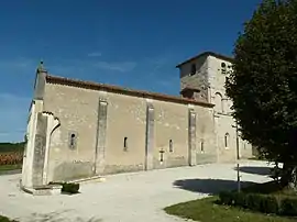 The church in Saint-Félix | |
Location of Saint-Félix | |
 Saint-Félix  Saint-Félix | |
| Coordinates: 45°22′33″N 0°00′41″E / 45.3758°N 0.0114°E | |
| Country | France |
| Region | Nouvelle-Aquitaine |
| Department | Charente |
| Arrondissement | Cognac |
| Canton | Charente-Sud |
| Intercommunality | 4B Sud-Charente |
| Government | |
| • Mayor (2020–2026) | Marie-Claire Aubrit[1] |
| Area 1 | 8.08 km2 (3.12 sq mi) |
| Population | 104 |
| • Density | 13/km2 (33/sq mi) |
| Time zone | UTC+01:00 (CET) |
| • Summer (DST) | UTC+02:00 (CEST) |
| INSEE/Postal code | 16315 /16480 |
| Elevation | 84–175 m (276–574 ft) (avg. 150 m or 490 ft) |
| 1 French Land Register data, which excludes lakes, ponds, glaciers > 1 km2 (0.386 sq mi or 247 acres) and river estuaries. | |
Saint-Félix is a commune in the Charente department in southwestern France.
Population
| Year | Pop. | ±% p.a. |
|---|---|---|
| 1968 | 205 | — |
| 1975 | 175 | −2.23% |
| 1982 | 136 | −3.54% |
| 1990 | 118 | −1.76% |
| 1999 | 119 | +0.09% |
| 2009 | 115 | −0.34% |
| 2014 | 118 | +0.52% |
| 2020 | 105 | −1.93% |
| Source: INSEE[3] | ||
See also
References
- ↑ "Répertoire national des élus: les maires". data.gouv.fr, Plateforme ouverte des données publiques françaises (in French). 2 December 2020.
- ↑ "Populations légales 2021". The National Institute of Statistics and Economic Studies. 28 December 2023.
- ↑ Population en historique depuis 1968, INSEE
Wikimedia Commons has media related to Saint-Félix (Charente).
This article is issued from Wikipedia. The text is licensed under Creative Commons - Attribution - Sharealike. Additional terms may apply for the media files.