Vouharte | |
|---|---|
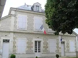 Town hall | |
Location of Vouharte | |
 Vouharte  Vouharte | |
| Coordinates: 45°48′59″N 0°04′31″E / 45.8164°N 0.0753°E | |
| Country | France |
| Region | Nouvelle-Aquitaine |
| Department | Charente |
| Arrondissement | Confolens |
| Canton | Boixe-et-Manslois |
| Intercommunality | Cœur de Charente |
| Government | |
| • Mayor (2022–2026) | Patrick Michonneau[1] |
| Area 1 | 10.64 km2 (4.11 sq mi) |
| Population | 323 |
| • Density | 30/km2 (79/sq mi) |
| Time zone | UTC+01:00 (CET) |
| • Summer (DST) | UTC+02:00 (CEST) |
| INSEE/Postal code | 16419 /16330 |
| Elevation | 42–137 m (138–449 ft) (avg. 45 m or 148 ft) |
| 1 French Land Register data, which excludes lakes, ponds, glaciers > 1 km2 (0.386 sq mi or 247 acres) and river estuaries. | |
Vouharte (French pronunciation: [vu.aʁt]) is a commune in the Charente department in southwestern France.
Population
| Year | Pop. | ±% p.a. |
|---|---|---|
| 1968 | 280 | — |
| 1975 | 313 | +1.60% |
| 1982 | 340 | +1.19% |
| 1990 | 339 | −0.04% |
| 1999 | 330 | −0.30% |
| 2009 | 325 | −0.15% |
| 2014 | 326 | +0.06% |
| 2020 | 326 | +0.00% |
| Source: INSEE[3] | ||
See also
References
- ↑ "Répertoire national des élus: les maires" (in French). data.gouv.fr, Plateforme ouverte des données publiques françaises. 16 December 2022.
- ↑ "Populations légales 2021". The National Institute of Statistics and Economic Studies. 28 December 2023.
- ↑ Population en historique depuis 1968, INSEE
Wikimedia Commons has media related to Vouharte.
This article is issued from Wikipedia. The text is licensed under Creative Commons - Attribution - Sharealike. Additional terms may apply for the media files.