Drásov | |
|---|---|
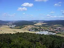
 Panorama of Drásov | |
 Flag  Coat of arms | |
 Drásov Location in the Czech Republic | |
| Coordinates: 49°19′55″N 16°28′41″E / 49.33194°N 16.47806°E | |
| Country | |
| Region | South Moravian |
| District | Brno-Country |
| First mentioned | 1238 |
| Area | |
| • Total | 10.70 km2 (4.13 sq mi) |
| Elevation | 270 m (890 ft) |
| Population (2023-01-01)[1] | |
| • Total | 2,041 |
| • Density | 190/km2 (490/sq mi) |
| Time zone | UTC+1 (CET) |
| • Summer (DST) | UTC+2 (CEST) |
| Postal code | 664 24 |
| Website | www |
Drásov is a market town in Brno-Country District in the South Moravian Region of the Czech Republic. It has about 2,000 inhabitants.
Geography
Drásov is located about 15 kilometres (9 mi) northwest of Brno. It lies mostly in the Boskovice Furrow, only the forested hills in the northwestern part of the municipal territory lies in the Upper Svratka Highlands. The highest point is a hill at 476 m (1,562 ft) above sea level.
History
The first written mention of Drásov is in a deed of King Wenceslaus I from 1238.[2] Drásov was known for its vineyards, which existed here until the 19th century, and for the mining of red sandstone in several quarries in the vicinity.[3]
Demographics
|
|
| ||||||||||||||||||||||||||||||||||||||||||||||||||||||
| Source: Censuses[4][5] | ||||||||||||||||||||||||||||||||||||||||||||||||||||||||
Sights
The main landmark of Drásov is the Church of the Exaltation of the Holy Cross. It is a medieval Gothic church with Baroque modifications. In the interior there are partly preserved Gothic wall paintings.[6]
Notable people
- Vladimír Šmeral (1903–1982), actor
- Michal Hašek (born 1976), politician; former mayor of Drásov
References
- ↑ "Population of Municipalities – 1 January 2023". Czech Statistical Office. 2023-05-23.
- ↑ "Oslavy výročí 785 let založení Městyse Drásov" (in Czech). Městys Drásov. Retrieved 2023-11-29.
- ↑ "O Drásově: Z historie" (in Czech). Městys Drásov. Retrieved 2023-11-29.
- ↑ "Historický lexikon obcí České republiky 1869–2011 – Okres Brno-venkov" (in Czech). Czech Statistical Office. 2015-12-21. pp. 3–4.
- ↑ "Population Census 2021: Population by sex". Public Database. Czech Statistical Office. 2021-03-27.
- ↑ "Kostel Povýšení sv. Kříže" (in Czech). National Heritage Institute. Retrieved 2023-11-29.