Favières | |
|---|---|
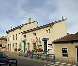 The town hall and school in Favières | |
 Coat of arms | |
Location of Favières | |
 Favières  Favières | |
| Coordinates: 48°27′48″N 5°57′19″E / 48.4633°N 5.9553°E | |
| Country | France |
| Region | Grand Est |
| Department | Meurthe-et-Moselle |
| Arrondissement | Toul |
| Canton | Meine au Saintois |
| Intercommunality | CC Pays de Colombey et Sud Toulois |
| Government | |
| • Mayor (2020–2026) | Valerie Hoffmann[1] |
| Area 1 | 29.5 km2 (11.4 sq mi) |
| Population | 590 |
| • Density | 20/km2 (52/sq mi) |
| Time zone | UTC+01:00 (CET) |
| • Summer (DST) | UTC+02:00 (CEST) |
| INSEE/Postal code | 54189 /54115 |
| Elevation | 308–471 m (1,010–1,545 ft) (avg. 337 m or 1,106 ft) |
| 1 French Land Register data, which excludes lakes, ponds, glaciers > 1 km2 (0.386 sq mi or 247 acres) and river estuaries. | |
Favières (French pronunciation: [favjɛʁ] ⓘ) is a commune in the Meurthe-et-Moselle department in north-eastern France.
See also
References
- ↑ "Répertoire national des élus: les maires" (in French). data.gouv.fr, Plateforme ouverte des données publiques françaises. 4 May 2022.
- ↑ "Populations légales 2021". The National Institute of Statistics and Economic Studies. 28 December 2023.
Wikimedia Commons has media related to Favières (Meurthe-et-Moselle).
This article is issued from Wikipedia. The text is licensed under Creative Commons - Attribution - Sharealike. Additional terms may apply for the media files.